Catalog Archive
Auction 92, Lot 114

"Le Canada, ou Nouvelle France, &c.", Sanson, Nicolas

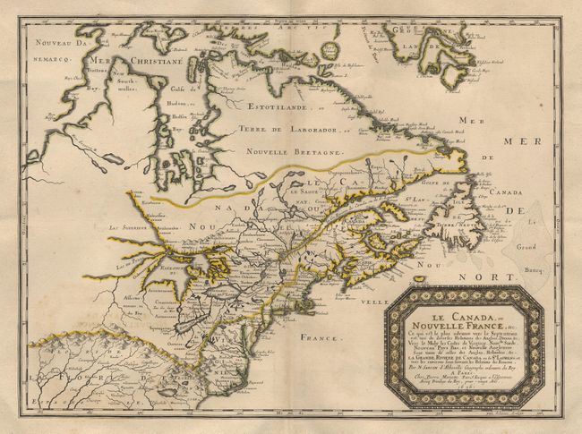
Subject: Colonial United States and Canada

Period: 1656 (dated)

Publication:

Color: Hand Color

Size:
21.5 x 15.7 inches
54.6 x 39.9 cm
Download High Resolution Image
(or just click on image to launch the Zoom viewer)

One of the most influential 17th century maps of eastern North America and a keystone map for Great Lakes collections. Sanson based the map primarily on Jesuit sources, retaining Champlain's basic cartographic model for the northern parts of Canada. He added some nomenclature of James, Foxe, and Button and retained the earlier concept of Button's Northwest Passage, in the southwest corner of the bay. The most important aspect of the map is the first appearance of "L. Erie, ou du Chat" as a recognizable lake. This delineation influenced the cartography of the region for over 100 years and was not superceded until De l'Isle's "Carte du Canada" in 1703. The entire Great Lakes basin and the St. Lawrence River is shown in great detail. Lake Superior and Michigan (Lac du Puans) are left open-end to the west. Other geographical improvements introduced with this map include a more detailed Hudson Bay, introduction of Long Island, and the correct position of New Amsterdam. The boundary lines reflect the French version of territorial boundaries.

References: Burden #318; Kershaw #81.

Condition: A+

Trimmed to just outside neatline and mounted on a larger sheet of fine 17th or early 18th century paper for binding into a composite atlas (a common practice at the time). Superb impression and original outline color.

Estimate: $4,000 - $4,500

Sold for: $3,250

Closed on 9/13/2000

Archived