Catalog Archive
Auction 92, Lot 103

"Partie Orientale de la Nouvelle France ou du Canada avec l'Isle de Terre-Neuve et de Nouvelle Ecosse, Acadie et Nouv. Angleterre…", Lotter, Tobias Conrad
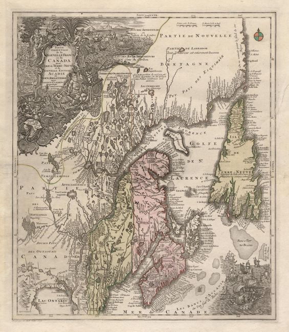
Subject: Canada

Period: 1756 (circa)

Publication:

Color: Hand Color

Size:
19.5 x 22.7 inches
49.5 x 57.7 cm
Download High Resolution Image
(or just click on image to launch the Zoom viewer)

A beautiful map of Northeastern Canada, including Nova Scotia, Labrador and Newfoundland. This is the second state of the map originally drawn by Seutter and engraved by Lotter, with the title cartouche changed to replace Seutter's name with Lotter. The map's vertical format elongates the geography and distorting Newfoundland. The St. Lawrence River runs nearly north-south. It is very detailed, especially along the coastlines and rivers. Many place names, both European and Indian. At bottom right is a scene with several sailing ships. At top left is a huge decorative title cartouche featuring allegorical figures, Indian chiefs, explorers, mapmakers, a fleet of ships, fishermen and wildlife.

References: Kershaw #344; Moreland and Bannister, p. 90.

Condition: A

Backed with Japanese tissue to repair a small tear within the map, else fine.

Estimate: $2,000 - $2,300

Sold for: $1,500

Closed on 9/13/2000

Archived