Catalog Archive
Auction 91, Lot 93
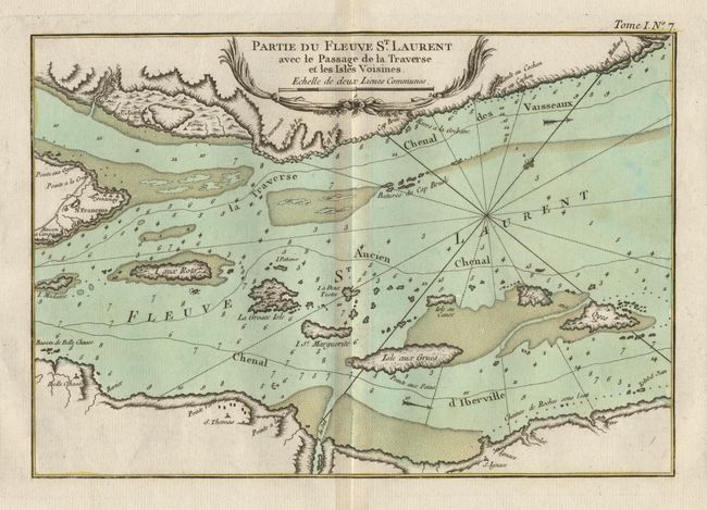
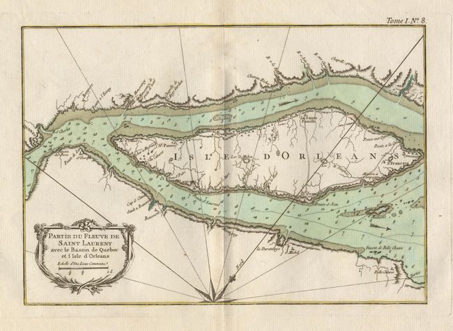
"Partie du Fleuve de Saint Laurent avec le Bassin de Quebec et l'Isle d'Orleans [together with] Partie du Fleuve St Laurent avec le Passage de la Travers et les Isles Voisines",
1 of 2
Subject: Canada
Period: 1764 (published)
Publication: Le Petit Atlas Maritime
Color: Hand Color
Size:
11.5 x 8 inches
29.2 x 20.3 cm
Download High Resolution Image
(or just click on image to launch the Zoom viewer)
(or just click on image to launch the Zoom viewer)