Catalog Archive
Auction 91, Lot 76

"A New Mapp of America Septentrionale Designed by Mousieu Sanson Geographer to the French King, and Rendered into English, and Illustrated by Richard Blome…",

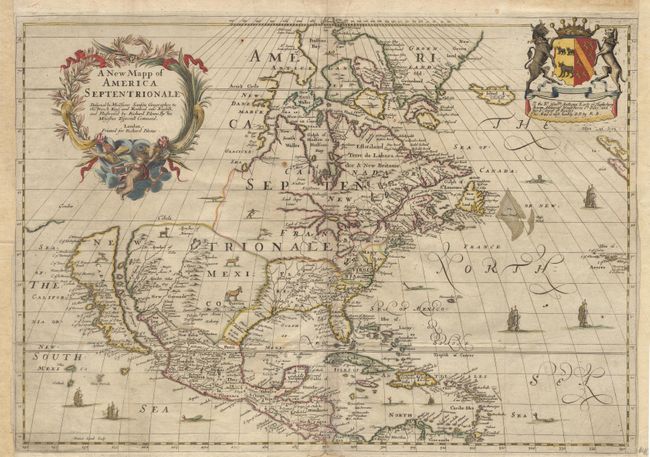
Subject: North America

Period: 1682 (published)

Publication: Cosmography and Geography

Color: Hand Color

Size:
21.7 x 15.5 inches
55.1 x 39.4 cm
Download High Resolution Image
(or just click on image to launch the Zoom viewer)

This is the first English map to portray all five Great Lakes based on the Sanson model. Newfoundland is improved with the depiction of the Avalon peninsula, and the mid-Atlantic coastline is also improved. CALIFORNIA IS AN ISLAND. Richard Blome was a prolific publisher of cartographic and heraldic material who utilized the subscription method to finance his ventures. The upper right corner of this map bears the arms and dedication to "Anthony Earle of Shaftesbury". The whole map is covered with depictions of indigenous animals, and ships and sea monsters decorate the oceans. This is the third state of the plate with Carolina now named. Ref: Burden #397; Tooley (America) p.119; and McLaughlin #42. Old repair of bottom centerfold, and remargined at sides with a tiny bit of neatline facsimile. $ 2,000 RESERVE

References:

Condition: A

Estimate: $2,500 - $2,750

Sold for: $2,200

Closed on 6/14/2000

Archived