Catalog Archive
Auction 91, Lot 185

"Carte du Golphe du Méxique et des Isles de l'Amérique",
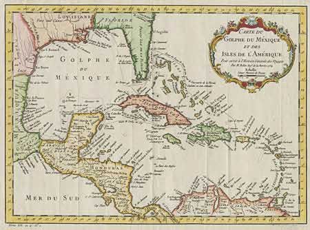
Subject: Caribbean

Period: 1754 (dated)

Publication: L'Histoire Générale des Voyages

Color: Hand Color

Size:
14.7 x 10.7 inches
37.3 x 27.2 cm
Download High Resolution Image
(or just click on image to launch the Zoom viewer)

Charming map of the islands of the Caribbean, which includes those parts of the United States & Mexico that border the Gulf of Mexico, Central America, and the northern coastline of South America. Routes of several explorers are shown with many coastal place names. Sharp impression with a beautifully colored title cartouche. One tiny marginal tear, well away from image, else fine.

References:

Condition: A

Estimate: $350 - $425

Sold for: $400

Closed on 6/14/2000

Archived