Catalog Archive
Auction 91, Lot 177

"An Accurate Map of the West Indies Drawn form the best Authorities…",

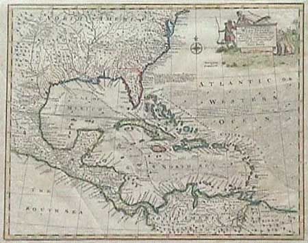
Subject: Colonial United States and West Indies

Period: 1763 (circa)

Publication:

Color: Hand Color

Size:
16.5 x 13.5 inches
41.9 x 34.3 cm
Download High Resolution Image
(or just click on image to launch the Zoom viewer)

Attractive copper engraved map covering the southeastern United States, eastern Mexico, Central America and the West Indies. The British colonies are confined east of the Appalachians with France in control of Louisiana. Many early forts are located. Interesting notations concerning the history of the region; "K. Charles II by Charter dated June 30th 1665 granted the E. of Caredon, D. of Albermarle, &c. the Province of Carolina, extending Southward to the 20 Deg. of N. Latitude so that Fort St. Augustin as well as Georgia falls within these limits." Trade winds and sea routes marked throughout. Title cartouche with Native Americans and an incongruous lion. Folding as issued and now pressed. Later color which is incomplete, else fine.

References:

Condition: A

Estimate: $350 - $425

Sold for: $650

Closed on 6/14/2000

Archived