Catalog Archive
Auction 91, Lot 138

"Lands Ceded by Sioux, Sacs, Foxes, Otoes, Ioways & C. in 1825",

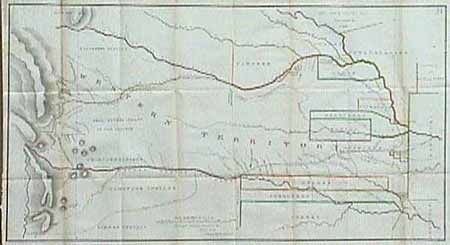
Subject: Central United States

Period: 1836 (published)

Publication: Journal of the Expedition…under the Comman of Colonel Henry P. Dodge…

Color: Hand Color

Size:
34.5 x 19.4 inches
87.6 x 49.3 cm
Download High Resolution Image
(or just click on image to launch the Zoom viewer)

A superb lithographed map covering the region of present day Kansas, Nebraska, and Colorado. The various Indian territories are delineated and colored in outline. The route of the Dragoons is shown starting at Ft. Levenworth and following the "Santa Fe Road" and then the Arkansas River (also marked as the United States Boundary) to just before Pike's Peak, then moving north through the "Sanke & Crow's War Ground" to the return trip along the Platte River. Folding, as issued with very light toning along outside fold and a bit of faint foxing, still very good condition.

References:

Condition: A

Estimate: $400 - $450

Sold for: $550

Closed on 6/14/2000

Archived