Catalog Archive
Auction 91, Lot 110

"Sheet 1 [A Map of the British Empire in America…]",
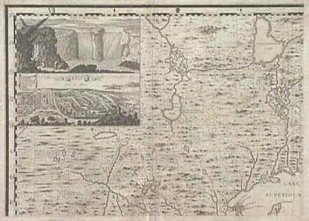
Subject: Colonial Canada and United States

Period: 1733 (published)

Publication:

Color: Black & White

Size:
26.1 x 19.3 inches
66.3 x 49 cm
Download High Resolution Image
(or just click on image to launch the Zoom viewer)

First sheet of Henry Popple's great 20 sheet map of America. This sheet includes the large inset views of Niagara Falls, and the plan of Mexico City. This section covers the region north and west of Lake Superior, including the supposed source of the Mississippi River, "The Heads of ye Missisipi in about the Fiftieth degree of Northern Latitude and in a very Boggy Country". Popple made use of both French and English maps, with De l'Isles "Carte de la Louisiana", being a major source of information for this sheet. A very fine, dark impression. Professional repair of centerfold and a bit of roughness in top margin.

References:

Condition: A

Estimate: $1,400 - $1,600

Sold for: $700

Closed on 6/14/2000

Archived