Catalog Archive
Auction 90, Lot 76

"Canada ou Nouvelle France suivant les Nouvelles Observations",

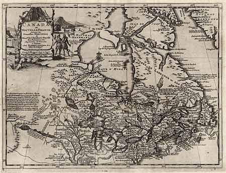
Subject: Colonial Canada and United States

Period: 1714 (circa)

Publication: Nouvel Atlas

Color: Black & White

Size:
11.7 x 8.7 inches
29.7 x 22.1 cm
Download High Resolution Image
(or just click on image to launch the Zoom viewer)

First state of this beautifully engraved map of Eastern Canada and the Great Lakes region based on De l'Isle's important map of 1703. Lahontan's mythical "Longue River" is shown linking a large western lake with the Mississippi River. It is thought that the lake's origin is derived from Indian stories concerning the Great Salt Lake. The map is filled with place names, Indian tribes and interesting notations. Large title cartouche surrounded by scenes of natives and indigenous animals. Short binding tear, expertly repaired, else very fine, crisp impression.

References:

Condition: A

Estimate: $275 - $350

Sold for: $350

Closed on 3/15/2000

Archived