Catalog Archive
Auction 89, Lot 93

"Carte du Territoire de'Arkansa et des autres Territoires des Etats-Unis",

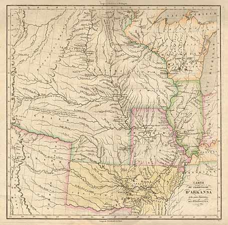
Subject: Central United States

Period: 1825 (published)

Publication:

Color: Hand Color

Size:
14.2 x 14.2 inches
36.1 x 36.1 cm
Download High Resolution Image
(or just click on image to launch the Zoom viewer)

Superb map of the early western territories, including the large ARKANSAS TERRITORIY, and early western border in Missouri. The map extends to the Rocky Mountains and the plains are labeled "Grand Desert". Numerous Indian villages are shown based on information gained from the Lewis and Clarke expedition and other important exploration routes are shown. The map is surrounded in French text.

References:

Condition: A+

Estimate: $550 - $600

Sold for: $700

Closed on 12/8/1999

Archived