Catalog Archive
Auction 89, Lot 203

"Plan of St. Petersburg, with its Fortifications, built by Peter the Great in 1703",
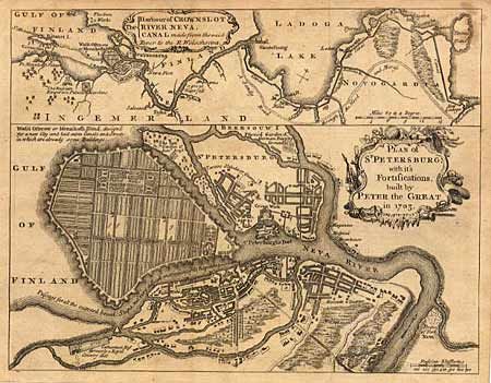
Subject: Russia

Period: 1749 (published)

Publication: Gentlemen's Magazine

Color: Black & White

Size:
9.7 x 7.5 inches
24.6 x 19.1 cm
Download High Resolution Image
(or just click on image to launch the Zoom viewer)

A fine copper engraved map of the city and fort with a decorative title cartouche. It shows Menzikoffs Island which was designed for a new city with all the streets and canals laid out, but very little built at the time. Above the map is another map titled "The Harbour of Crownslot River Neva, Canal made from the said River to the R. Wolschowa". This maps depicts the vicinity from the Emperor's palace, west of St. Petersburg, to the Wolschowa River. Ref: Jolly #GENT-65 A tiny bit of foxing, still overall very good.

References:

Condition: A

Estimate: $60 - $80

Sold for: $85

Closed on 12/8/1999

Archived