Catalog Archive
Auction 88, Lot 51

"Geographical, Historical, and Statistical Map of America", Lavoisne, C. V.

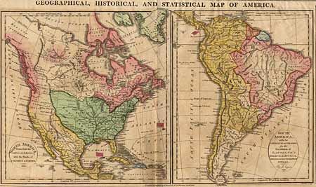
Subject: Western Hemisphere

Period: 1813 (dated)

Publication:

Color: Hand Color

Size:
15.7 x 9.2 inches
39.9 x 23.4 cm
Download High Resolution Image
(or just click on image to launch the Zoom viewer)

Two maps on a folio sheet surrounded by English text containing a great history of the Americas. In North America the United States is shown to include the new purchase of Louisiana but stopping short of the Pacific coast, which is shown to belong to Britain. Spain controls Florida, Mexico and the southwest. South America is shown divided between Spain and Portugal except for French and Dutch Guyana, with the heart of the Amazon and Patagonia still possessed by native peoples. A bit of light discoloration, overall very good.

References:

Condition: A

Estimate: $150 - $180

Sold for: $130

Closed on 10/2/1999

Archived