Catalog Archive
Auction 88, Lot 301

"Taprobana Ins.", Servetus, Michael
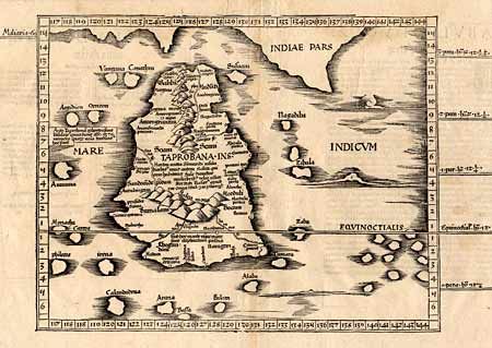
Subject: Sri Lanka

Period: 1535 (published)

Publication: Ptolemy's Geographia

Color: Black & White

Size:
14 x 11 inches
35.6 x 27.9 cm
Download High Resolution Image
(or just click on image to launch the Zoom viewer)

Great early woodblock map of the island of Ceylon. The map is largely based on the 1513 map by Walseemuller, with the addition of more of the spurious Indian coastline and more small islands to the east of Ceylon. The compiler of this edition, Michael Servetus, was subsequently tried for heresy and burned at the stake in 1553, ostensibly because of derogatory comments in the atlas about the Holy Land. Fine sharp impression.

References:

Condition: A+

Estimate: $700 - $800

Unsold

Closed on 10/2/1999

Archived