Catalog Archive
Auction 192, Lot 50

"Nuova Carta del Polo Artico", Tirion/Albrizzi
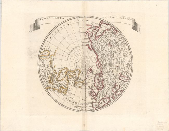
Subject: North Pole

Period: 1740 (circa)

Publication: Atlante Novissimo...

Color: Hand Color

Size:
12.8 x 11 inches
32.5 x 27.9 cm
Download High Resolution Image
(or just click on image to launch the Zoom viewer)

This north polar projection includes the northern part of the island of California with the Pacific region left completely blank. There is good detail in Europe and Asia, with even the Great Wall of China shown, while relatively little detail appears in North America. The Mississippi River extends west and connects with a large lake, Gnacsitares, that almost reaches the West Coast, based on the embellished account of Baron de Lahontan. Quivira and Santa Fe are also noted in the west. Greenland is connected to both the North Pole and Canada. Ribbon style title cartouche. Kershaw attributes this map to Delisle

References: Kershaw #416; McLaughlin #216-3.

Condition: A

Fine impression and color with huge margins on a sheet with the watermark of three crescent moons. Hint of centerfold toning and blush of printer's ink at left outside hemisphere.

Estimate: $200 - $230

Sold for: $150

Closed on 4/26/2023

Archived