Catalog Archive
Auction 192, Lot 36

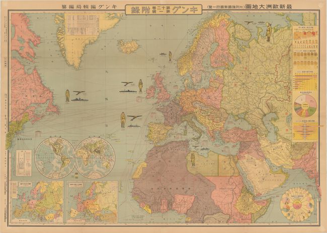
"[Japanese Map - Latest Map of Europe (With an Overview of the National Strength and Defences of the Major Powers)]",

Subject: World, World War II

Period: 1936 (published)

Publication:

Color: Printed Color

Size:
41.6 x 29 inches
105.7 x 73.7 cm
Download High Resolution Image
(or just click on image to launch the Zoom viewer)

This wall-sized map presents Japan's view of Europe and surrounding powers just prior to the outbreak of World War II. The map is densely packed with information on the size of the armed forces, land mass, population, economy, trade relations, railways, ports, and telecommunications of key countries. A soldier, plane and ship are depicted for Germany, France, Britain, Italy, the Soviet Union and the United States, with the numbers below each indicating how many were at each country's disposal. Inset maps of Europe at bottom left show the ethnic distribution of peoples and the borders prior to World War I. At right are additional tables and charts giving detail on the relative population and wealth of each country. The two round charts illustrate Japan's imports and exports with the major powers in Europe and with the United States. This map was created by Fuchida Tadayoshi and published by Dai Nippon Yubenkai Kodansha as a supplement to King magazine.

References:

Condition: B+

Lightly toned, issued folding with minor wear along the folds and a few small pin holes in the blank margins.

Estimate: $160 - $190

Sold for: $160

Closed on 4/26/2023

Archived