Catalog Archive
Auction 192, Lot 31

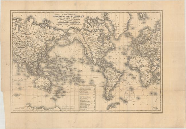
Scarce Map of Proposed Overland Telegraph to Europe

"P. McD. Collins' Proposed Overland Telegraph via. Behrings Strait and Asiatic Russia to Europe, Under Russian & British Grants", Colton, Joseph Hutchins

Subject: World

Period: 1864 (dated)

Publication:

Color: Black & White

Size:
24.9 x 16.8 inches
63.2 x 42.7 cm
Download High Resolution Image
(or just click on image to launch the Zoom viewer)

This scarce map of the world reflects Perry McDonough Collins’ ambitious plan to link Europe with America by an overland telegraph line across Russian America (Alaska) and Siberia to Moscow. Collins believed that crossing the relatively short Behring Strait was an easier task than crossing the Atlantic Ocean and set his ambitious plan in motion in 1865. The map presents both completed and proposed lines throughout the world, with only the small section from San Francisco to Olympia noted as complete. Collins didn’t make it very far, however, as Cyrus Field’s Atlantic cable reached the Canadian coastline in 1866, rendering Collins’ project obsolete. The map was prepared by H.P. Cooper and published by J.H. Colton.

References: Rumsey #2893; Streeter Sale #3529.

Condition: B+

Issued folding on thin paper with a few minor stains and numerous short fold separations that have been closed on verso with archival tape.

Estimate: $250 - $325

Sold for: $150

Closed on 4/26/2023

Archived