Catalog Archive
Auction 192, Lot 23

"The World Including the Discoveries, Made by Capt. Cook",
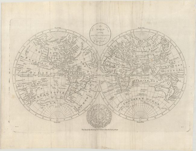
Subject: World

Period: 1790 (circa)

Publication: New, Royal, and Authentic System of Universal Geography

Color: Black & White

Size:
17.1 x 10.6 inches
43.4 x 26.9 cm
Download High Resolution Image
(or just click on image to launch the Zoom viewer)

This attractive double-hemisphere world map depicts the voyages and discoveries of Captain James Cook. Alaska is shown with a fairly correct shape with a notation along its northern coastline, "according to the Japanese." The Sandwich Islands are shown and noted as the place where Capt. Cook was killed. The South Pacific is filled with islands, and New Zealand is fully formed. Tasmania is still attached to Australia, which is shown with an unexplored coastline between Lewins Land and Diemens Land.. There are numerous notations throughout and the tracks of Cook's three voyages. An inset of the North Pole, showing a less developed Alaska, is tucked between the hemispheres at bottom with the title cartouche balancing the composition at top. This is the second state with the addition of "82H" at bottom left and "8G" at bottom right. Published in Thomas Bankes' New, Royal, and Authentic System of Universal Geography.

References: McCorkle (18th C. Geography Books) #11-3.

Condition: B+

There is some extraneous creasing mostly in the middle of the sheet and a couple minor spots.

Estimate: $375 - $450

Unsold

Closed on 4/26/2023

Archived