Catalog Archive
Auction 192, Lot 20

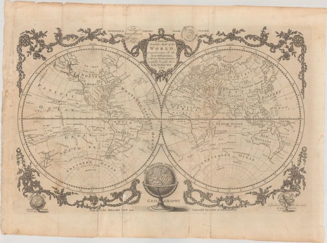
"A New and Accurate Map of the World, Comprehending All the New Discoveries, in Both Hemisphere; Carefully Brought Down to the Present Year 1782", Millar, Andrew

Subject: World

Period: 1782 (dated)

Publication: Millar's New and Universal System of Geography

Color: Black & White

Size:
18.2 x 11.8 inches
46.2 x 30 cm
Download High Resolution Image
(or just click on image to launch the Zoom viewer)

This handsome double hemisphere world map appeared in both Millar's System of Geography and George Augustus Baldwyn's A New, Royal, Authentic, Complete and Universal System of Geography in 1782. The map reflects the discoveries of Captain Cook, with his tracks shown throughout. The voyages of Anson and Furneaux are traced as well. Alaska is beginning to take proper shape. Tasmania is still shown attached to the mainland, and New Zealand is fully formed. The coastline of New Guinea is incomplete, and there are several fragments of coast nearby. Several Pacific islands are depicted, including the Sandwich Islands. The hemispheres are surrounded by a floral garland with geographical circles and the solar system flanking the title cartouche at top. At bottom are terrestrial and celestial globes and an armillary sphere.

References:

Condition: B

Issued folding with light dampstains at left and archival repairs to a couple of fold separations at bottom as well as a small chip in the decorative border at bottom. Extraneous creases adjacent to the folds have been archivally reinforced on verso.

Estimate: $300 - $375

Sold for: $150

Closed on 4/26/2023

Archived