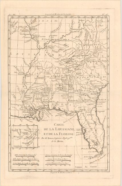
"Carte de la Louisiane, et de la Floride", Bonne, Rigobert
Subject: Colonial Southern United States
Period: 1780 (circa)
Publication: Atlas de Toutes les Parties Connues du Globe Terrestre
Color: Black & White
Size:
8.1 x 12.5 inches
20.6 x 31.8 cm
This handsome map of the American Southeast and the Mississippi River Valley extends from Charleston, South Carolina west to include New Orleans and north into southern Illinois. In this French-produced map Louisiana extends to the Appalachian Mountains bordering the southern colonies. The Mississippi and Ohio rivers are well delineated. Florida is shown with its panhandle extending west to include Mobile and Biloxi. Locates Charles Town, Savannah, St. Augustine, Mobile, Pensacola, and several far western settlements and forts in the frontier. A small inset provides details of the Missouri River. Six distance scales fill the Gulf of Mexico.
References:
Condition: A
On watermarked paper with a few minor spots and a touch of offsetting.