Catalog Archive
Auction 191, Lot 82

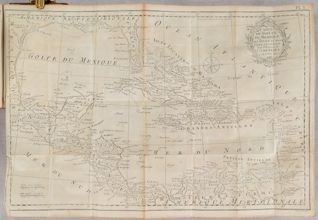
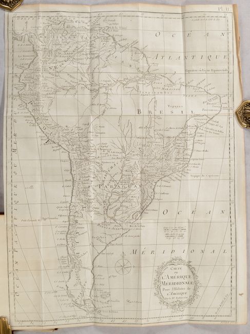
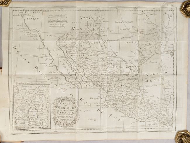
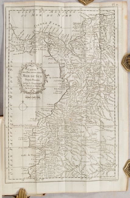
"[4 Maps in Book] L'Histoire de l'Amerique ... Tome Quatrieme",

Subject: Western Hemisphere - America

Period: 1780 (published)

Publication:

Color: Black & White

Size:
4 x 6.8 inches
10.2 x 17.3 cm
Download High Resolution Image
(or just click on image to launch the Zoom viewer)

This is volume four (of four) from the second French edition of William Robertson's History of America. It contains books seven and eight from Robertson's English edition and all four of the called for maps for this French edition, which were engraved by Benard. The list of maps include:

A. Carte du Golfe du Mexique, des Isles et des Pays Adjacens pour l'Histoire de l'Amerique..., (19.1 x 12.4"). This map extends from Florida, along the Gulf Coast, to northern South America. The southern part of Florida is shown as a confusing series of islands. Presents good detail of the West Indies and coastline of Central and South America. Condition: Light toning. (B+)

B. Carte de l'Amerique Meridionale..., (12.9 x 17.6"). This map provides good detail of rivers, lakes, mountain ranges and settlements. A large section of the interior of Brazil is left mostly blank. Small remnants of the mythical lakes Parime and Xarayes still appear. Condition: On a bright sheet. (A)

C. Carte du Mexique ou de la Nouvelle Espagne, ou l'on Peut Suivre les Mouvemens des Costes..., (15.1 x 11.3"). A detailed map of the American Southwest and Mexico. California is labeled New Albion (Nouvelle Albion) with no detail outside of a few coastal place names. The region of present-day Arizona and New Mexico is well delineated with numerous Indian villages and the locations of missions. The area from New Mexico to Louisiana is named as "Great Space of Land Unknown." The small Texas settlement of Cenis is north of the Nou. Royaume de Leon. An inset shows Mexico City on the large Lake of Mexico. Condition: There is one small spot at upper right, otherwise fine. (A)

D. Carte des Pays Situes sur la Mer du Sud Depuis Panama Jusqu'a Guayaquil..., (9.5 x 14.6"). This map stretches from Costa Rica to Colombia and the tip of Peru in the south. It depicts settlements, rivers and a few roads. The map is adorned by a decorative floral title cartouche and a simple compass rose. Condition: On a bright sheet with faint offsetting. (A)

434 pages. Hardbound in full contemporary leather with raised bands and gilt decorations on spine.

References: Howes #R-358; Sabin #71990.

Condition:

The maps are issued folding. See description for condition grades and additional details. Text is clean, bright and fine. Covers are worn and abraded and the spine has small chips at the head and tail.

Estimate: $300 - $375

Sold for: $150

Closed on 2/8/2023

Archived