Catalog Archive
Auction 191, Lot 449

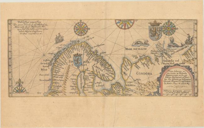
"Vera Delineatio Totius Tractus ex Hollandia Septentrionem Versus per Fretrum Nassouicum, ad Fluvium Oby Ducentes, ex Annotatione Iohannis Hugouis Lintschottani, de Annis 1594 et 1595, Etc.", Bry, Theodore de
Subject: Arctic & Scandinavia

Period: 1613 (circa)

Publication:

Color: Hand Color

Size:
13.2 x 5.4 inches
33.5 x 13.7 cm
Download High Resolution Image
(or just click on image to launch the Zoom viewer)

This copper engraving is from a remarkable series of publications, illustrating voyages of discovery and travels of exploration to various parts of the world. The project was begun by Theodore de Bry of Frankfurt, in 1590 and was to continue for another 54 years. They became known collectively as the Grands Voyages (to America and the West Indies) and the Petits Voyages (to the Orient and the East Indies). De Bry died after the first six parts of the Grands Voyages were completed. The project was completed initially by his widow and two sons, Johann Theodore de Bry and Johann Israel de Bry, then by his son-in-law, Matthaus Merian in 1644.

This handsome, boldly engraved map is derived from Linschoten's important chart depicting the discoveries of Barent's first and second voyages to the Arctic in search of a northeast passage to Asia. The map provides excellent information on the northern coastline of Scandinavia to the west coast of Novaya Zemlya. It is richly adorned with compass roses, ships, coats of arms, seals, and sea monsters. It was either published in Theodore de Bry's Petits Voyages or Levinus Husius' translation of de Bry; both were apparently printed from the same copperplate.

References: Ginsberg #49.2.

Condition: B+

A crisp impression on a lightly toned sheet with the watermarks of a small coat of arms and a horn. There is a printer's crease at bottom center with a minor adjacent tear that has been archivally repaired.

Estimate: $1,200 - $1,500

Sold for: $650

Closed on 2/8/2023

Archived