Catalog Archive
Auction 191, Lot 34

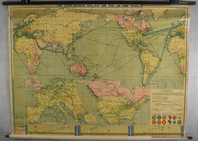
"The Navy League Sea and Air Map of the World", Philip, George

Subject: World

Period: 1933 (circa)

Publication:

Color: Printed Color

Size:
45.4 x 34.8 inches
115.3 x 88.4 cm
Download High Resolution Image
(or just click on image to launch the Zoom viewer)

"Produced under the auspices of the Navy League and edited in co-operation with the Air League of the British Empire," this informative wall map highlights air and sea routes all over the world. A legend at bottom right identifies British air routes (projected and in operation), foreign air routes (projected and in operation), sea routes, overseas branches of the Navy League, and the insignia of various international aircraft. Areas colored pink are part of the British Empire, while the rest of the world is yellow. Insets provide a closer look at Europe and the United States and Canada. Tables below the map compare height, speed, duration, and distance of aircraft from 1906 to 1932.

References:

Condition: B

Still attached to original rollers with a 3" tear and moderate dampstain at the top of the map. The varnish is yellowing with light wear.

Estimate: $200 - $230

Sold for: $150

Closed on 2/8/2023

Archived