Catalog Archive
Auction 191, Lot 166

"A Map of the United States of America Agreeable to the Peace of 1783", Guthrie, William

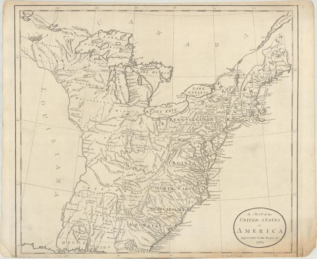
Subject: Eastern United States

Period: 1786 (published)

Publication: Guthrie's New System of Geography

Color: Black & White

Size:
15.4 x 13.9 inches
39.1 x 35.3 cm
Download High Resolution Image
(or just click on image to launch the Zoom viewer)

This early map depicts the young United States following the Treaty of Paris. The map shows New York and Pennsylvania both bordering Lake Ontario. In the far northeast the territory of Sagahadok is a large region above the barely mentioned Main. Lake Superior is unapologetically filled with fictitious islands. The region west of the Mississippi River is completely blank with no features, but good detail is provided along its east side including several named Indian villages. It is interesting that the map locates none of the Revolutionary War Bounty Land Grants. There is good detail east of the Appalachian mountains, but the region between the mountains, the Mississippi River and the Canadian border contain no named regions but it is filled with Indian lands, forts, small towns and villages, and gives good watershed detail. Curiously, Detroit is not located. The map just extends to the northern portion of Florida which is divided into east and west regions. Under the control of Spain, Florida had been ceded by England to the Spanish in gratitude for their neutrality during the American Revolutionary War. Engraved by Wm. Darton of Tottenham. Blank verso.

References: McCorkle (Geography Books) #183-21; Shirley (BL Atlases) T.GUTH-6a #21.

Condition: B

On a sheet with the watermarks of "Taylor" and a horn coat of arms. Most of the lower neatline, including the engraver's signature, has been trimmed away. There are a couple tiny edge tears and light toning at bottom right.

Estimate: $350 - $425

Sold for: $250

Closed on 2/8/2023

Archived