Catalog Archive
Auction 191, Lot 142

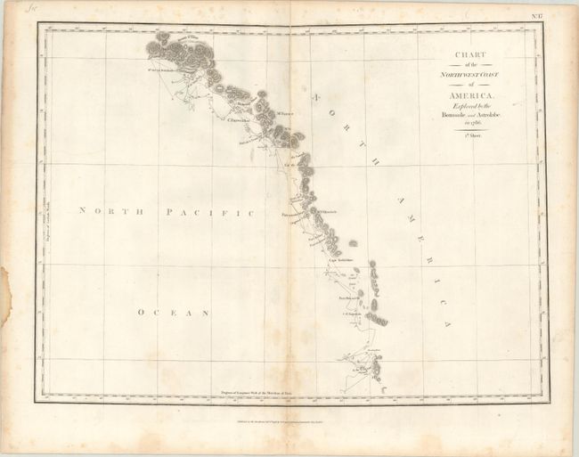
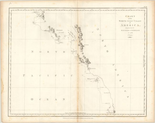
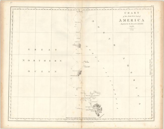
"[On 3 Sheets] Chart of the North West Coast of America. Explored by the Boussole, and Astrolabe in 1786", La Perouse, Comte Jean F. Galoup, de

Subject: Western United States & Canada

Period: 1798 (dated)

Publication: A Voyage Round the World...

Color: Black & White

Size:
19.3 x 14.3 inches
49 x 36.3 cm
Download High Resolution Image
(or just click on image to launch the Zoom viewer)

Jean-Francois de Galoup, Comte de La Perouse commanded a French scientific expedition to the Pacific in 1785-88. Recognized as one the foremost naval commanders and navigators in France, he was selected by King Louis XVI to complete Captain James Cook's exploration of the western Pacific. The British Admiralty provided scientific equipment to measure variations in magnetic compass readings and with the latest instruments for determining longitude. La Perouse explored the coasts of the Gulf of Alaska and northwestern North America in search of the fabled Northwest Passage. After leaving America his expedition continued on to Asia where he explored from Macao to Kamchatka and the Solomon Islands in the South Pacific. La Perouse was meticulous in sending copies of his extensive logs, maps and surveying information via other ships as well as overland. La Perouse's last contact was in the spring of 1788 with a British ship in Botany Bay, Australia. The expedition was never heard from again. Considered one of the greatest French voyages, the French Government decided to publish the story of the expedition when it became clear they had been lost. An English edition was published in London.

This chart was issued on three sheets, each with their own borders, and depicts the exploration of the West Coast of North America by La Perouse between June and September 1786. The route begins at Mount St. Elias in Alaska on June 24 and finishes at Monterey, California on September 12. The track of the ships with dates and other information is shown. There are many coastal place names, but only those parts actually observed and surveyed are noted. The chart locates Cape Tschirikow, Port Bucarelli, Cape St. Augustin, Nootka (Vancouver Island), Woode Pt., B. St. Louis, the Port of San Francisco, Point Bodega, the Capes of Mendocino, Blanco, and Foul-weather and more. Puget Sound and the Columbia River are conspicuously missing since this exploration took place six years before the discovery of Puget Sound by Vancouver. From the English edition, published by G.G. & J. Robinson just two years after the French edition.

References: Falk #1798-6; Phillips (A) #693; cf. Wagner #841, 843 & 844.

Condition: B

Nice impressions with scattered foxing, light staining along the centerfold, and archival repairs to several centerfold separations, particularly on the first sheet.

Estimate: $500 - $650

Sold for: $250

Closed on 2/8/2023

Archived