Catalog Archive
Auction 191, Lot 137

"Nieuwe Kaart van Kanada, de Landen aan de Hudsons-Baay en de Noordwestelyke Deelen van Noord-Amerika", Tirion, Isaac

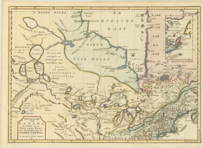
Subject: Colonial Northeastern United States & Canada

Period: 1769 (dated)

Publication: Hedendaagsche Historie of Tegenwoordige Staat van Amerika…

Color: Hand Color

Size:
17.4 x 12.3 inches
44.2 x 31.2 cm
Download High Resolution Image
(or just click on image to launch the Zoom viewer)

This attractive and detailed map is based on Jefferys' important map of Canada in 1760. It covers from Hudson Bay, through the Great Lakes, to Philadelphia and west to include Lake Winnipeg. There is an interesting array of speculative cartography in the lakes and rivers. While there is a realistic interpretation of Lake Winnipeg, it connects via the Rivier Bourbon to Hudson Bay, and also gives rise to the Mississippi River. The St. Charles River, which connects with the Mississippi, flows off the map to the west with a notation in Dutch, "the length of which is unknown, this is the route the Indians follow coming from the West." Several Hudson Bay Company forts and numerous Indian villages are located. An inset illustrates the Gulf of St. Lawrence.

References: Kershaw #375; McCorkle #769.2; Shirley (BL Atlases) G.TIR-1a #24.

Condition: A

Issued folding, now flattened with a narrow right margin.

Estimate: $275 - $350

Sold for: $325

Closed on 2/8/2023

Archived