Catalog Archive
Auction 191, Lot 121

"L'Isle de Montreal et ses Environs", Bellin, Jacques Nicolas

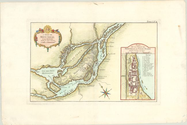
Subject: Montreal, Canada

Period: 1764 (circa)

Publication: Le Petit Atlas Maritime

Color: Hand Color

Size:
13.6 x 8.5 inches
34.5 x 21.6 cm
Download High Resolution Image
(or just click on image to launch the Zoom viewer)

A well-engraved map that shows the islands of Montreal and Jesus in great detail. Montreal (here Ville Marie) is depicted as a walled and fortified city. The map locates the forts Roland, Gde. Ance, Pte. Claire, Ste. Anne, Ste. Genevieve, and more. Also included are the surrounding islands of Ste. Therese, S. Andre, Perot, Bizard, etc. A large inset at right contains a "Plan de la Ville de Montreal ou Ville Marie" with a legend locating and naming fifteen important buildings. The chart features a rococo-style cartouche that incorporates a distance scale. Compass rose and fleur-de-lis further decorate the chart.

References: Kershaw #1108.

Condition: A

A crisp impression on a bright sheet with a few minor chips along the bottom sheet edge.

Estimate: $400 - $475

Sold for: $200

Closed on 2/8/2023

Archived