Catalog Archive
Auction 191, Lot 114

"A General Chart of the Island of Newfoundland with the Rocks & Soundings. Drawn from Surveys Taken by Order of the Right Honourable the Lords Commissioners of the Admiralty...", Jefferys/Sayer & Bennett

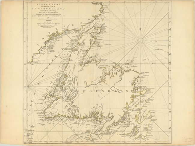
Subject: Newfoundland, Canada

Period: 1775 (dated)

Publication: The American Atlas

Color: Hand Color

Size:
22 x 21.4 inches
55.9 x 54.4 cm
Download High Resolution Image
(or just click on image to launch the Zoom viewer)

Thomas Jefferys was one of the most important English map publishers of the 18th century. His work included prints and maps of locations around the world, but his most notable maps are of North America and the West Indies. He began his career in the map trade in the early 1730s, working as an engraver for a variety of London publishers, and eventually setting up his own shop. In 1746, he was appointed Geographer to the Prince of Wales, and in 1760 he became Geographer to the King. These titles granted access to manuscripts and cartographic information held by the government. In the early 1760s he embarked on an ambitious project to produce a series of English county maps based on new surveys, but ran out of money and filed for bankruptcy in 1766. He then partnered with London publisher Robert Sayer, who reissued many of Jefferys plates and continued to issue new editions after Jefferys' death in 1771. Jefferys' American Atlas and the accompanying West-India Atlas, published post posthumously, are considered his most important cartographic works.

A wonderful sailing chart with minute detail of the coast and small islands, and little in the interior except for the rivers and lakes. Shows the Straits of Bell Isle and the Labrador coast, illustrating the northern approach to the St. Lawerence River. An attractive chart with rhumb lines, a fleur-de-lys, and numerous soundings in the Gulf waters. Dated 10 May 1775.

References: Shirley (BL Atlases) T.JEF-2a #12.

Condition: B+

A nice impression with contemporary outline color on a sheet with a large Strasbourg Lily watermark and trimmed just within the neatline at top by the bookbinder. There are several archivally repaired tears, including a couple of 1" tears near the center of the map and 3 marginal tears at bottom. Light toning along the edges of the sheet.

Estimate: $350 - $425

Sold for: $250

Closed on 2/8/2023

Archived