Catalog Archive
Auction 190, Lot 622

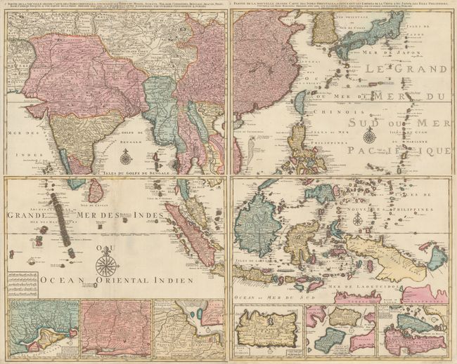
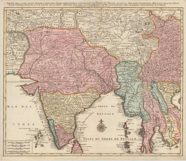
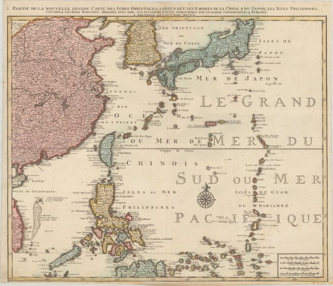
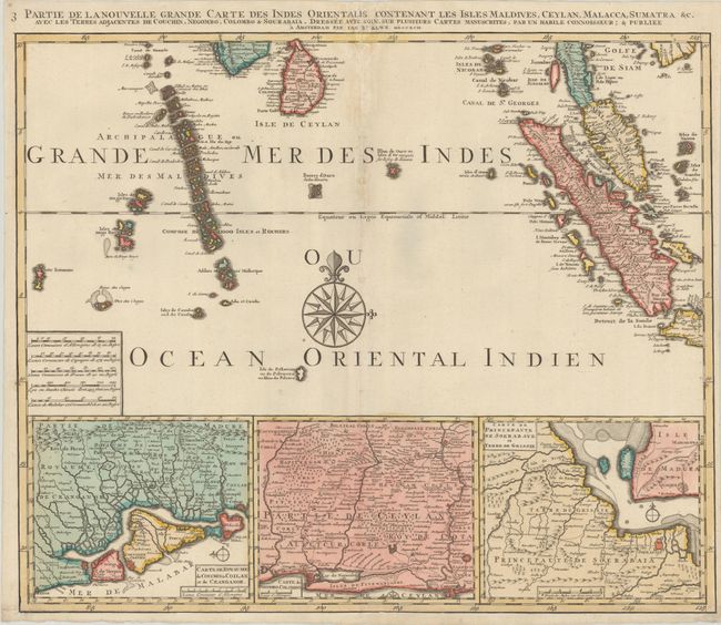
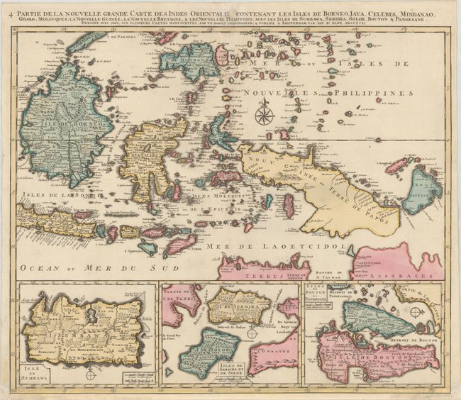
Superb Wall-Sized Map in Full Contemporary Color

"[On 4 Sheets] Partie de la Nouvelle Grande Carte des Indes Orientales...", Elwe, Jan Barend

Subject: Southern & Southeast Asia

Period: 1792 (dated)

Publication:

Color: Hand Color

Size:
23.9 x 19.9 inches
60.7 x 50.5 cm
Download High Resolution Image
(or just click on image to launch the Zoom viewer)

A matching set of maps that encompass most of southern and Southeast Asia, extending to include China, Korea and Japan. Each map stands on its own with full borders and a title above the map. If fully joined, the map would measure approximately 47" x 38.5".

A. Partie de la Nouvelle Grande Carte des Indes Orientales, Contentant les Terres du Mogol, Surate, Malabar, Cormandel, Bengale, Aracan, Pegu, Siam, Camboje, Tonquin, & une Partie de la Chine... This sheet is focused on the Bay of Bengal and details the region from the Pakistani border across India to the Indo-Chinese peninsula with Burma, Cambodia, Vietnam and Laos, showing quite a bit of China and the northern half of Sri Lanka. The Bengal Gulf is adorned with a large compass rose.

B. ... Contentant les Empires de la Chine & du Japon, les Isles Philippines, Couchin, & les Isles Marianes... This sheet details the western coast of China, with Korea and Japan as well as the Phillipines, Borneo, and the Marianas.

C. ... Contenant les Isles Maldives, Ceylan, Malacca, Sumatra &c... This sheet is centered on a large compass rose. It details the Maldives, Sri Lanka, Sumatra and the Malaysian Peninsula with three inset detail maps along the bottom including a part of the Malabar coastline, a part of the Sri Lankan coast including Negombo, and the Maduran Strait between Java and Madura.

D. ... Contenant les Isles de Borneo, Iava, Celebes, Mindanao, Gilolo, Molucques, la Nouvelles Guinee, la Nouvelle Bretagne, & les Nouvelles Phelippines... This sheet is focused on the island of Borneo, Celebes, Java, New Guinea, Mindanao and the Philippines. The bottom of the map is inset with three maps-the island of Sumbawa, the islands of Solor and Sebira, and the islands of Bouton and Pangesane. The northern coast of Australia is shown at bottom right.

References:

Condition: B+

Crisp impressions with full contemporary color on bright sheets with elephant watermarks. There are light dampstains along the centerfold at top of each sheet resulting in some small abrasions, with a minor amount of the titles replaced in facsimile. Each sheet has been professionally remargined at bottom, with the neatline replaced in facsimile on two of the sheets. The first image is a composite image - this map is on 4 separate sheets.

Estimate: $2,400 - $3,000

Sold for: $1,800

Closed on 11/16/2022

Archived