Catalog Archive
Auction 190, Lot 357

"Accuratissima Angliae Regni et Walliae Principatus Descriptio Distincte Divisa in Omnes suas Provincias et Editia", Danckerts, Cornelius

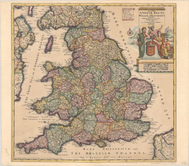
Subject: England & Wales

Period: 1696 (circa)

Publication:

Color: Hand Color

Size:
20.9 x 20.2 inches
53.1 x 51.3 cm
Download High Resolution Image
(or just click on image to launch the Zoom viewer)

Cornelis Danckerts, son of Justus Danckerts, made this map of England and Wales after setting up his own shop in Nieuwendyck in 1696. The map features terrific detail of England and Wales, delineating counties, highlighting postal roads, and naming many towns and cities. The key at top identifies towns large and small, villages, universities, castles, and more. Three allegorical female figures lean against the royal arms of England in the title cartouche, with a beautiful coastal scene in the background. There are four distance scales below the title.

References: Shirley (BI to 1750) Danckerts #3.

Condition: B+

A nice impression on a slightly toned sheet that has been professionally remargined on all four sides, with part of the border replaced in facsimile at top and bottom. There are archival repairs to a centerfold separation and edge tear at bottom.

Estimate: $400 - $475

Sold for: $300

Closed on 11/16/2022

Archived