Catalog Archive
Auction 190, Lot 333

"Les Isles Britanique ou se Trouvent les Royaumes d'Angletere, d'Ecosse, et d'Irlande...", Fer, Nicolas de
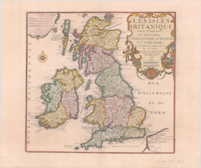
Subject: Britain

Period: 1706 (dated)

Publication: Atlas ou Recueil de Cartes Geographiques...

Color: Hand Color

Size:
18.8 x 17.9 inches
47.8 x 45.5 cm
Download High Resolution Image
(or just click on image to launch the Zoom viewer)

This attractive French map of the British Isles is embellished with a large decorative title cartouche. It is the largest of De Fer's maps of the British Isles, with the exception of the four-sheet map he published in 1714. Instead of shires, it delineates provinces in England. Unusually, the latitude and longitude of major cities are noted in the cartouche at upper left. The large title cartouche at top right incorporates a trio of hunting hounds, a cockfighting vignette, and a coat of arms. The map is also graced with a fine compass rose.

References: Pastoureau, FER II C [46]; Shirley (BI to 1750) De Fer #6.

Condition: B+

On a sheet with wide margins and the watermark of the Maltese cross encircled by rosary beads. There are two wormtracks at bottom that have been professionally repaired with a couple small sections of border replaced in facsimile.

Estimate: $240 - $300

Sold for: $180

Closed on 11/16/2022

Archived