Catalog Archive
Auction 189, Lot 7

"L'Hydrographie ou Description de l'Eau c'est a Dire des Mers, Golfes, Lacs, Destroits, et Rivieres Principales, qui sont dans la Surface du Globe Terrestre", Sanson, Nicolas
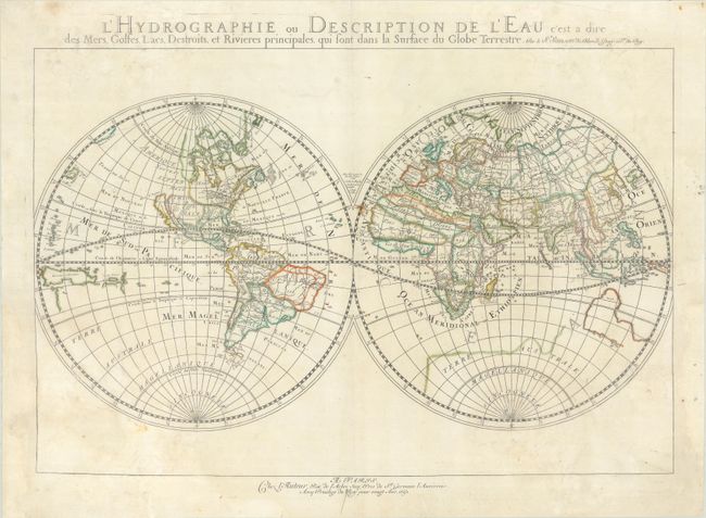
Subject: World

Period: 1652 (dated)

Publication:

Color: Hand Color

Size:
20.6 x 13.8 inches
52.3 x 35.1 cm
Download High Resolution Image
(or just click on image to launch the Zoom viewer)

This uncommon double hemisphere world map exemplifies the more austere style of Nicolas Sanson, often referred to as the 'the father of French cartography.' Whereas the Dutch cartographers are known for their fabulous decorations and coloring, the French cartographers, led by Sanson, are known for pioneering the scientific method of cartography. The map is similar to Sanson's 1651 edition (Shirley #390), but with more prominence given to marine and river features. California is shown as an island. On this map, Sanson has renamed Nouvelle Albion in the northwest part of North America as Terra de Iesso, and the Destr. d'Anian has been moved to just north of California. It is one of the first maps to distinguish the Great Lakes. Australia is only partially shown, still marked Beach, and there is a faint outline of the southern continent labeled Terre Australe Magellanique et Incogneue. This appears to be a later edition or impression because the conjectural coastlines for Terre de Iesso and the southern continent are barely visible.

References: Shirley #394; Wagner #367.

Condition: B+

On a sheet with a large and elaborate coat of arms watermark and a small rust spot at center. There is dampstaining along the edges and in the corners that only minimally impacts the map itself, with archival reinforcement applied to some of the water damage on verso. A couple edge tears in unengraved areas at bottom have also been professionally repaired.

Estimate: $600 - $750

Sold for: $395

Closed on 9/14/2022

Archived