Catalog Archive
Auction 189, Lot 407

Uncommon and Early Sea Chart of Southeastern Sweden

"Zee Custe van Sweeden, Otrent de Westerwijck en Tgatt vann Stockholm, Beginnende va Kalmar...", Waghenaer, Lucas Jansz

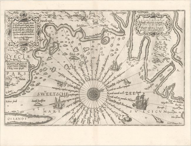
Subject: Southeastern Sweden

Period: 1585 (circa)

Publication:

Color: Black & White

Size:
20.1 x 12.9 inches
51.1 x 32.8 cm
Download High Resolution Image
(or just click on image to launch the Zoom viewer)

This uncommon and early sea chart covers the southern coast of Sweden from Kalmar and the island of Oland north to Stockholm. Soundings, anchorages, and a 32-point compass rose fill the Baltic Sea with place names located along the coastlines. The chart is richly decorated with ships and sea monsters in the water, with a bear, fox, wolf and goat illustrated on land. The title and distance scales are each enclosed by their own ornate cartouche. Waghenaer's charts are renowned for their fine engraving by the best craftsmen of the period including Theodore de Bry and the Doetecum brothers. This map was engraved by Joannes Doetecum. Latin text on verso.

References:

Condition: A

On a bright sheet with some light printer's ink residue.

Estimate: $1,400 - $1,700

Sold for: $1,000

Closed on 9/14/2022

Archived