Catalog Archive
Auction 189, Lot 118

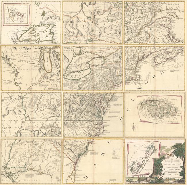
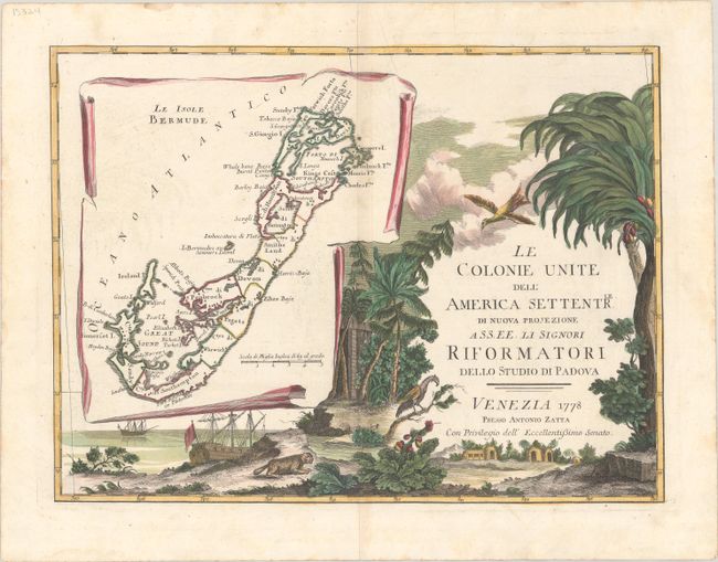
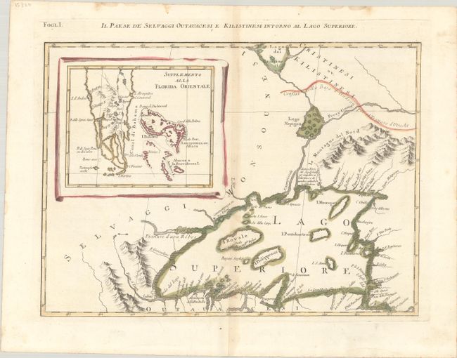
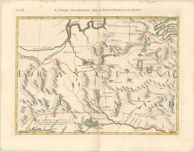
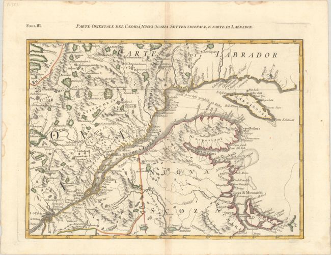
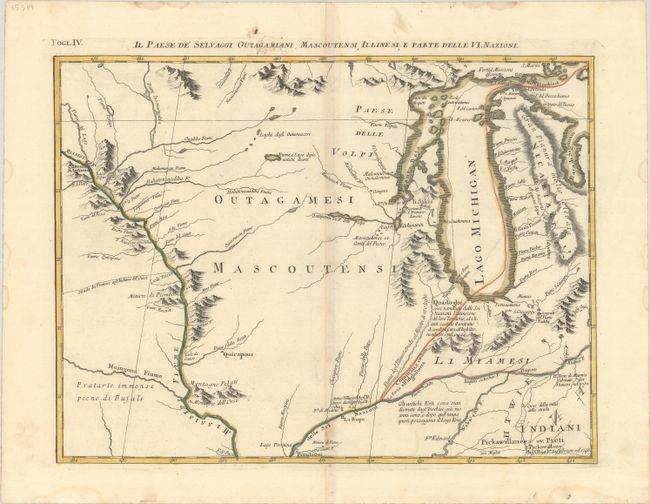
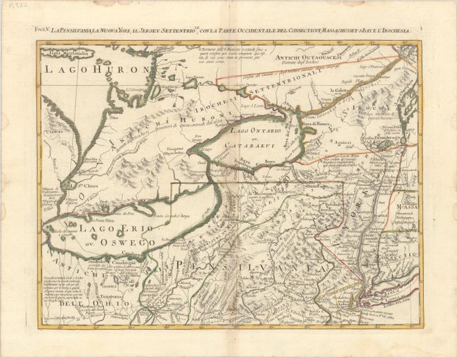
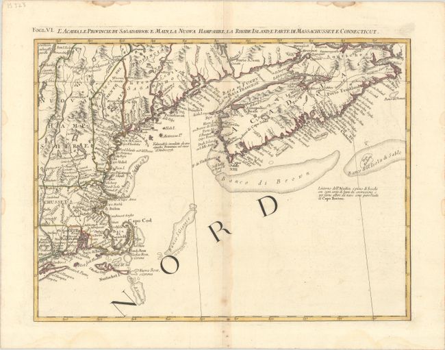
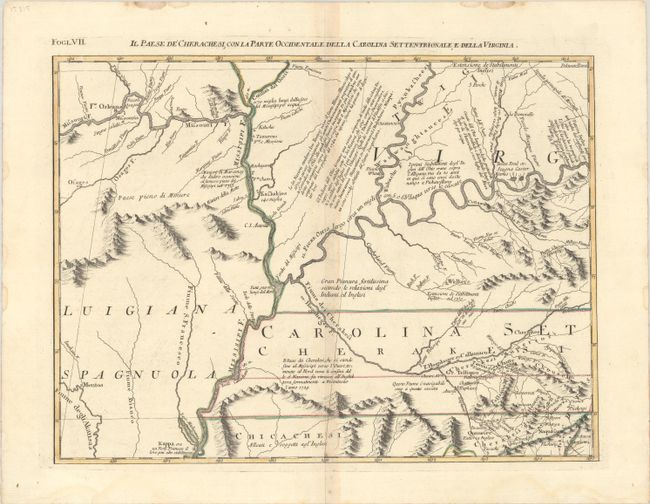
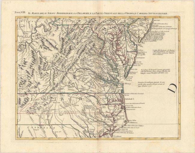
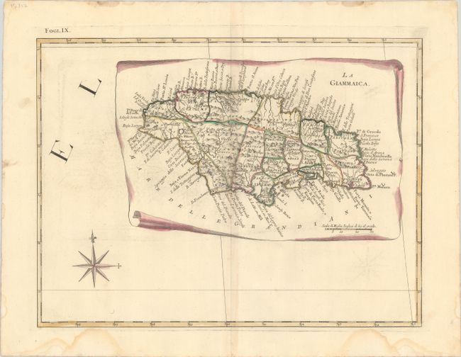
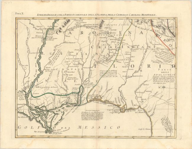
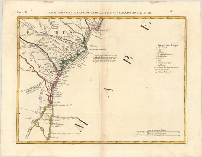
Impressive 12-Sheet Map of the New "United Colonies"

"[On 12 Sheets] Le Colonie Unite dell' America Settentrle. di Nuova Projezione...", Zatta, Antonio

Subject: Colonial Eastern United States & Canada

Period: 1778 (dated)

Publication: Atlante Novissimo

Color: Hand Color

Size:
16.9 x 12.6 inches
42.9 x 32 cm
Download High Resolution Image
(or just click on image to launch the Zoom viewer)

This impressive twelve-sheet map is Antonio Zatta's version of John Mitchell's landmark map with some additional notes relating to both the Treaty of 1763 and events in the Revolutionary War. Most importantly, Zatta's map was the first printed map devoted to the thirteen states, and to use a name distinguishing them from their previous status as British Colonies. The name 'United Colonies' was used in the Declaration of Independence and was not officially replaced until the Articles of Confederation adopted the name ‘The United States of America.’ The map covers North America west to the Mississippi and Spanish-owned Louisiana, and north to the Great Lakes. The title appears within a large full-color cartouche, which includes a large inset map of Bermuda and fills one sheet. A second inset shows Florida and the Bahamas, and a third features Jamaica. This set of 12 maps appeared in Zatta's Atlante Novissimo, which was first published in 4 volumes between 1775-85, with the fourth volume comprising maps of parts of the world outside of Europe. Sizes vary slightly.

A. [Title Sheet] Le Colonie Unite dell' America Settentrle. di Nuova Projezione... [on sheet with] Le Isole Bermude.
B. Il Paese de Selvaggi Outauchesi, e Kilistinesi Intorno al Lago Superiore.
C. La Parte Occidentale della Nuova Francia o Canada.
D. Parte Orientale del Canada, Nuova Scozia Settentrionale, e Parte di Labrador.
E. Il Paese de' Selvaggi Outagamiani, Mascoutensi, Illinesi, e Parte delle VI. Nazioni.
F. La Pensilvania, la Nuova York, il Jersey Settentriole., con la Parte Occidentale del Connecticut, Massachusset-s Baye l'Irochesia.
G. L'Acadia, le Provincie di Sagadahook e Main, la Nuova Hampshire, la Rhode Island, e Parte di Massachusset e Connecticut.
H. Il Paese de Cherachesi, con la Parte Occidentale, della Carolina Settentrionale, e della Virginia.
I. Il Maryland, il Jersey Meridionale, la Delaware, e la Parte Orientale della Virginia, e Carolina Settentrionale.
J. La Giammaica.
K. Luigiana Inglese, Colla Parte Occidentale della Florida, della Giorgia, e Carolina Meridonale.
L. Parte Orientale della Florida, della Giorgia, e Carolina Meridionale.

References: Portinaro & Knirsch pp.262-278; MapForum.com Vol. 1; Shirley (BL Atlases) T.ZAT-1a #27-38.

Condition: B+

Nice impressions with full contemporary color on bright sheets with the watermarks of three crescent moons. There is light toning along the centerfolds, small dampstains confined to the margins, and two small tears in the decorative elements on sheet one that have been archivally repaired on verso. The first image is a composite image - the map is in 12 separate sheets.

Estimate: $4,750 - $6,000

Sold for: $3,000

Closed on 9/14/2022

Archived