Catalog Archive
Auction 189, Lot 112

Map to Promote Canadian Trade via the St. Lawrence River

"Mercators Projection. With the Great Circle (Shortest Sailing) or Air Lines, Illustrating the Directness & Capacity of the River St. Lawrence from Lake Erie to the Atlantic...", Keefer, Thomas C.

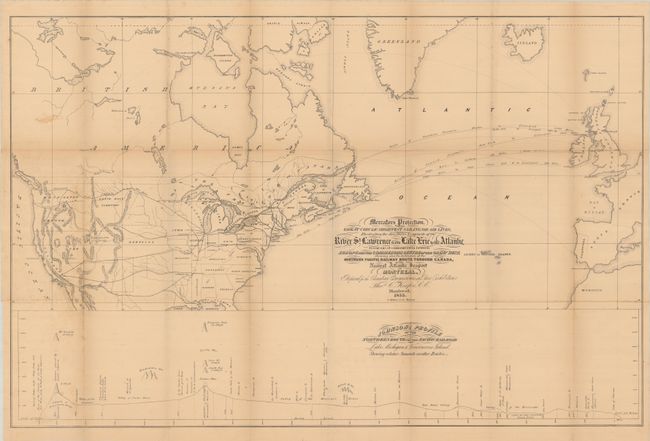
Subject: Canada & United States, Atlantic Ocean

Period: 1855 (dated)

Publication:

Color: Black & White

Size:
34.8 x 22.5 inches
88.4 x 57.2 cm
Download High Resolution Image
(or just click on image to launch the Zoom viewer)

This fascinating persuasive map extends from Western Europe to the Pacific Ocean, showing both existing and proposed railroads in North America and the connecting Steamer routes across the Atlantic Ocean. It was purposely designed to show the potential for Canadian ports to serve as gateways to the proposed transcontinental railroads. Dotted "Air Lines" (essentially continuations of the steamer routes on land) demonstrate that the most direct access to a potential northern transcontinental railroad would go though the St. Lawrence River, Lake Ontario and Lake Erie in route to Chicago. A profile at bottom entitled “Johnson’s Profile of the Northern Route for the Pacific Railroad…” further supports the northern route to Vancouver as it only has to pass two major summits in route to Vancouver or Portland. Another proposed railroad connecting Ottawa to the northern route would further establish the St. Lawrence River as an ideal trade route. Lithographed by G. Matthews and published in Montreal.

References:

Condition: B+

Issued folding with a hint of pleasant light toning. There is minor foxing, faint offsetting, and a few tiny splits at the fold junctions.

Estimate: $300 - $400

Sold for: $170

Closed on 9/14/2022

Archived