Catalog Archive
Auction 188, Lot 82

"Thermal Map of North America, Delineating the Isothermal Zodiac the Isothermal Axis of Intensity and Its Expansions Up and Down the Plateau", Gilpin, William

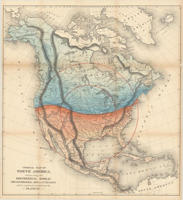
Subject: North America

Period: 1873 (circa)

Publication: Mission of the North American People, Geographical, Social and Political

Color: Hand Color

Size:
22.5 x 23.8 inches
57.2 x 60.5 cm
Download High Resolution Image
(or just click on image to launch the Zoom viewer)

Based upon Alexander von Humboldt's "isothermal zodiac," this map of North America shows a large temperate range south of the 40th parallel. Gilpin was a strong believer in climate influencing economic development, and the map suggests that the United States was well positioned to benefit from the favorable conditions. Additionally, the map uses concentric circles to represent the future population density with the center of population at Topeka, Kansas.

Gilpin was the first governor of the territory of Colorado and a proponent of the concept of Manifest Destiny, the transcontinental railway, and a westward expansion of the United States. He had radical ideas on how and why America should be populated, and to support his theories he created a series of maps including this one. Interestingly, Gilpin's maps were some of the first to show economic potential for the West and to think in terms of regional resources and climates.

References:

Condition: B

Issued folding with a short edge tear at left and numerous fold separations that have all been closed on verso with archival materials. There is light toning along the folds and a hint of color offsetting at bottom.

Estimate: $160 - $190

Sold for: $100

Closed on 6/22/2022

Archived