Catalog Archive
Auction 188, Lot 790

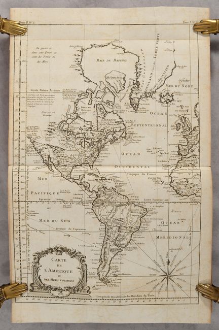
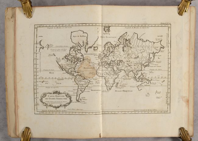
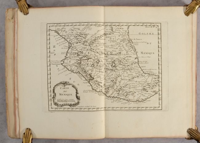
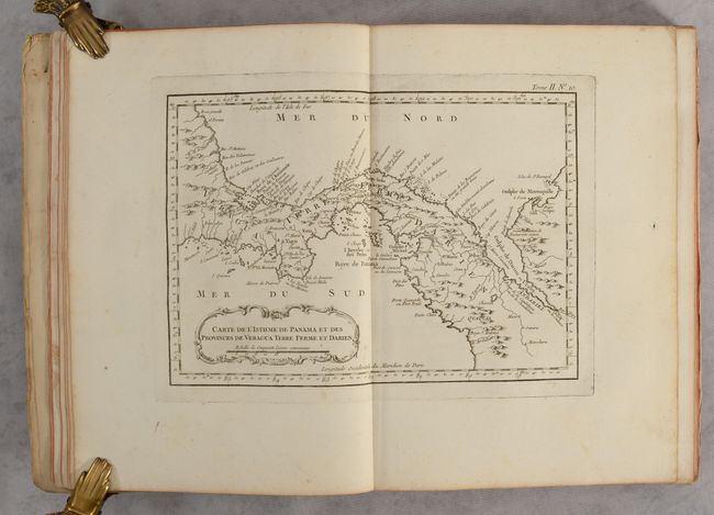
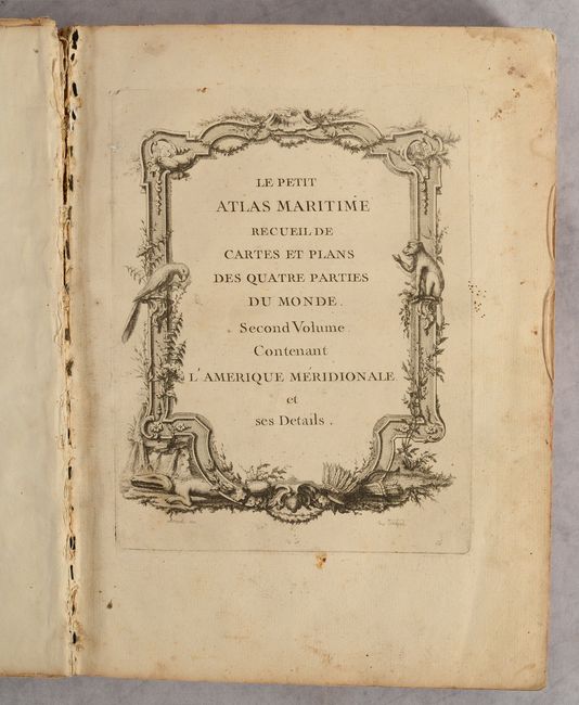
Bellin's Complete Atlas of Central & South America - 91 Maps

"Le Petit Atlas Maritime Recueil de Cartes et Plans des Quatre Parties du Monde. Second Volume. Contenant l'Amerique Meridionale et ses Details", Bellin, Jacques Nicolas

Subject: Atlases

Period: 1764 (circa)

Publication:

Color: Black & White

Size:
9.6 x 13.1 inches
24.4 x 33.3 cm
Download High Resolution Image
(or just click on image to launch the Zoom viewer)

This is the complete second volume from Bellin's Le Petit Atlas Maritime focused on Central and South America. It contains a total of 91 copper engraved maps including 36 double-page maps and a folding map of the western hemisphere. The atlas consists of the following maps: World (1), Western Hemisphere (1), Mexico (6), Central America (9), South America (71), and the Azores (3). The atlas features numerous regional maps, city plans, and coastal charts each with decorative title cartouches and uniform page numbers in the top right corner. Maps of particular interest include:

Carte de l'Amerique et des Mers Voisines (11.9 x 17.9"). A handsome map that shows the Western Hemisphere from Cape Horn to Baffin Bay, and to the western fringes of Europe and Africa. The northwestern United States and Canada are unexplored and left blank but for several notations regarding the unlikelihood of a northwest passage or the discoveries of Admiral de Fonte. However, a note indicates the possible location of the Mer de l'Ouest, or Sea of the West. The Mississippi River connects to Hudson Bay through a series of lakes and rivers.

Carte de l'Isthme de Panama et des Provinces de Veragua... (11.6 x 7.6"). An attractive map featuring good detail of Panama many years before the creation of the Canal and Lake Bayano. Numerous place names including S. Yago on the Azuevo Peninsula, Portobelo, Se. Marie, Panama, etc. Extends to include the Gulf of Darien.

Plan de la Baye de Rio-Janeiro (12.6 x 8.4"). This handsome map depicts Guanabara Bay with a bird's-eye plan of Rio de Janeiro. The decorative title cartouche contains a lettered key identifying 12 locations throughout the bay, including 6 forts. Guanabara Bay was first discovered on January 1, 1502 by Portuguese explorers Gaspar de Lemos and Goncalo Coelho, who originally named it Rio de Janeiro. The city of Rio de Janeiro was founded by the Portuguese in 1565 and became an important port for transporting the riches of the New World to Europe.

Carte Reduite du Detroit de Magellan Dressee sur les Journaux des Navigateurs (13.6 x 7.5"). Detailed chart of the Strait of Magellan locating harbors, islands, capes and bays from Cap des Vierges to Cap de la Victoire. The cartouche includes a lettered reference table for anchorages, bays, and harbors in the vicinity of Isle de Louis le Grand at the mid-point of the strait.

Carte Reduite de la Mer du Sud (14.0 x 8.3"). This map of the South Pacific presents nice detail of the region. Eastern Australia is shown with dotted lines connecting both Tasmania and New Guinea in a conjectural coastline. New Zealand is shown with only the western coastline demarcated. The Americas are shown from Baja California through Central America and the western coastline of South America including the Straits of Magellan and Cape Horn.

The atlas is completed by an engraved rococo-style title page drawn and engraved by Arrivet. Hardbound in paper covered boards.

References: Shirley (BL Atlases) M.BELL-5a-c.

Condition: B+

The maps have dark impressions and issued on sturdy paper. They are very good to mostly near fine with occasional foxing and offsetting. The world map has a dampstain near the center of the image (see photos) and there are occasional other dampstains confined to the blank margins. The hinges are starting and the spine has a small crack. Covers are moderately worn with bumped corners.

Estimate: $3,000 - $3,750

Sold for: $2,500

Closed on 6/22/2022

Archived