Catalog Archive
Auction 188, Lot 646

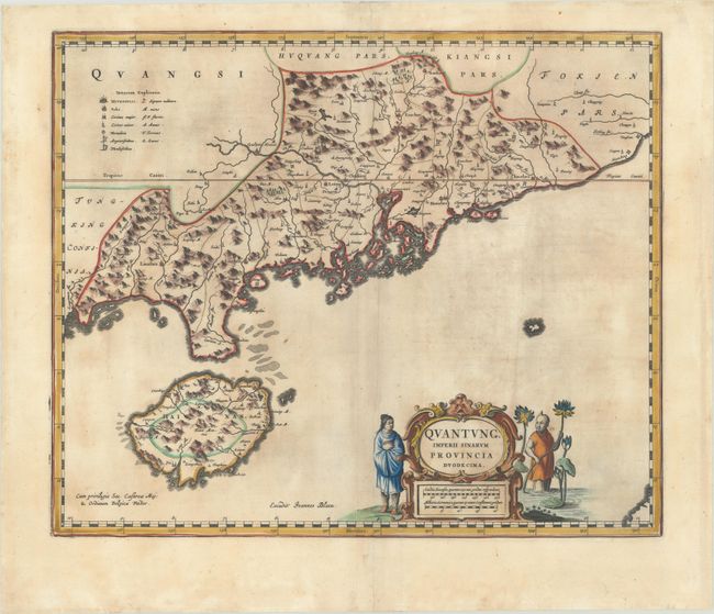
Old Color Example of Jesuit Map of Hong Kong & Canton

"Quantung, Imperii Sinarum Provincia Duodecima", Blaeu, Johannes

Subject: Southern China

Period: 1655 (published)

Publication: Novus Atlas Sinensis

Color: Hand Color

Size:
19.3 x 16 inches
49 x 40.6 cm
Download High Resolution Image
(or just click on image to launch the Zoom viewer)

Based on the remarkably accurate compilations of the Jesuit Father Martino Martini during his travels between 1643 and 1650, this map depicts the province of Guangdong (Quantung), on the southern shore of China, and extending to include Hainan. A legend at left identifies cities and towns of various sizes, forts, and mines for silver and lead. The mouth to the Pearl River is dotted with islands, including Macao and the islands that would eventually become Hong Kong. The important city of Guangzhou (Canton) is shown a little further north. The map is embellished with a strapwork cartouche flanked by Chinese figures and lotus flowers. Blank verso.

References: Van der Krogt (Vol. I) #8432:2.

Condition: B

A sharp impression with contemporary color that has been lightly refreshed, light toning, a repaired tear in the top right corner of the map, and a printer's crease adjacent to the centerfold. There are a couple of tiny tears along the edges of the sheet.

Estimate: $1,900 - $2,200

Unsold

Closed on 6/22/2022

Archived