Catalog Archive
Auction 188, Lot 22

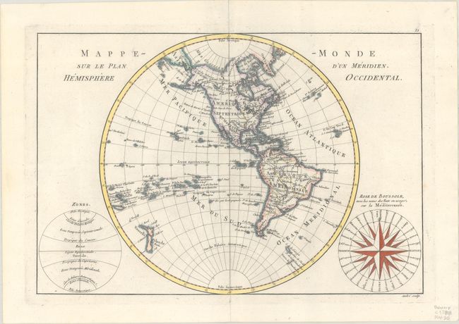
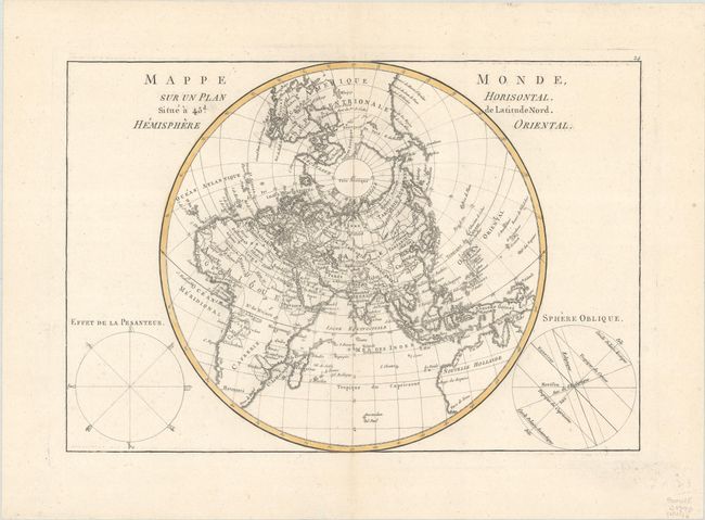
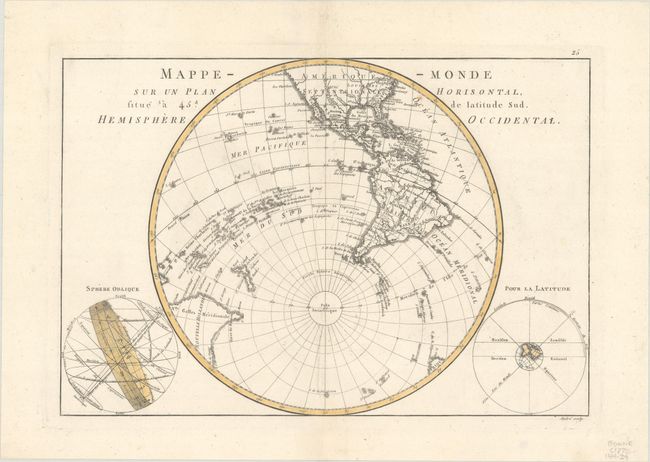
"[Lot of 3] Mappe-Monde sur le Plan d'un Meridien. Hemisphere Occidental [and] Mappe Monde, sur un Plan Horisontal ... Hemisphere Oriental [and] Mappe Monde sur un Plan Horisontal ... Hemisphere Occidental", Bonne, Rigobert

Subject: World

Period: 1770-88 (circa)

Publication:

Color: Hand Color

Size:
13.5 x 9.2 inches
34.3 x 23.4 cm
Download High Resolution Image
(or just click on image to launch the Zoom viewer)

A. Mappe-Monde sur le Plan d'un Meridien. Hemisphere Occidental, from Atlas Encyclopedique, circa 1788. Fine copper engraving shows North and South America with the Atlantic & Pacific Islands and New Zealand. Alaska is approximately the correct shape reflecting Cook's discoveries. At bottom right is a large wind rose called "Rose de Boussole," showing wind directions taken from charts in use in the Mediterranean Sea. A second diagram in the lower left corner balances the composition, with information on the poles and the circles of the earth. Engraved by Andre under the direction of Rigobert Bonne (1727-1795), the Director of the Depot de la Marine and Royal Hydrographer to the King, the map was published with Nicolas Demarest in his "Atlas Encyclopedique" in 1788. Condition: A crisp impression with very minor soiling in blank margins.

B. Mappe Monde, sur un Plan Horisontal. Situe a 45d. de Latitude Nord. Hemisphere Oriental, circa 1770. A fine circular chart, drawn with a north polar projection, with great detail of the countries, seas and oceans portrayed above the southern latitudes. The map extends to include the northern portion of North America and Australia. On either side of the map are two spheres, "Effet de la Pesanteur" and "Sphere Oblique," showing the equator, tropics, horizon & ecliptics. A fine example of the work of Rigobert Bonne, the Royal Hydrographer in Paris. Condition: A fine impression on watermarked paper with a couple of tiny, insignificant spots.

C. Mappe-Monde sur un Plan Horisontal, Situe a 45d. de Latitude Sud. Hemisphere Occidental, circa 1770. Attractive and finely engraved circular chart shows the southern regions of North America, South America, the South Pacific Ocean, Australia and New Zealand, drawn with a south polar projection. Australia is named Nouvelle Hollande and is still connected to Terre de Diemen. Two spheres are located on either side of the central chart, showing the circles around the earth of the latitudes, tropics, equator, zodiac and horizons. A fine example of the work of Rigobert Bonne, the Royal Hydrographer in Paris. Condition: A fine impression on watermarked paper with a minor paper flaw adjacent to centerfold.

References:

Condition: A

See description above.

Estimate: $375 - $450

Sold for: $275

Closed on 6/22/2022

Archived