Catalog Archive
Auction 187, Lot 673

Map Noting the Slave Trade Ports in Western Africa

"A New and Correct Map of the Coast of Africa from Cape Blanco … to the Coast of Angola…", Seale, Richard William

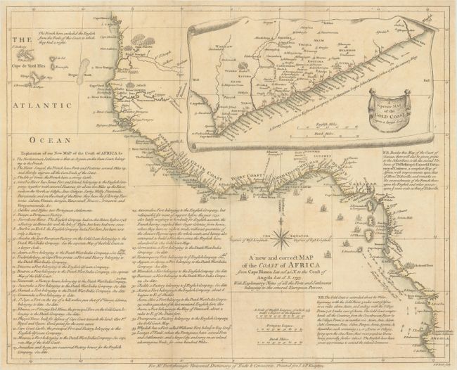
Subject: Western Africa

Period: 1753 (dated)

Publication: The Universal Dictionary of Trade and Commerce

Color: Hand Color

Size:
18.7 x 15 inches
47.5 x 38.1 cm
Download High Resolution Image
(or just click on image to launch the Zoom viewer)

This attractive map of the central western coast of Africa shows the various colonial possessions and notes the slave trade in the region. Detail is confined to the coast, with numerous place names, currents, navigational hazards, and tiny sailing ships. A large scroll-style inset depicts "A Map of the Gold Coast on a larger Scale." The map includes extensive notations on the various possessions as well as about the Gold Coast. Published in Postlethwayte's Universal Dictionary of Trade and Commerce.

References: cf. Shirley (BL Atlases) G.POST-1a #24.

Condition: B+

Issued folding, now pressed, on a sheet with a fleur-de-lis watermark. There is light scattered foxing and toning and a couple of short fold separations that have been closed on verso with archival tape.

Estimate: $400 - $475

Sold for: $475

Closed on 4/27/2022

Archived