Catalog Archive
Auction 187, Lot 29

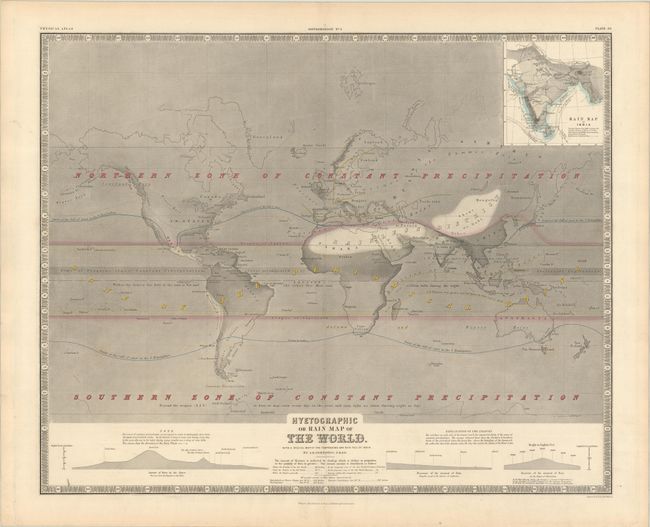
"Hyetographic or Rain Map of the World, with a Special Map of the Temperature and Rain Fall of India", Johnston, W. & A.K.

Subject: World

Period: 1855 (circa)

Publication: The Physical Atlas of Natural Phenomena

Color: Hand Color

Size:
23.8 x 19.1 inches
60.5 x 48.5 cm
Download High Resolution Image
(or just click on image to launch the Zoom viewer)

This fascinating, early thematic map meticulously notes patterns for precipitation across the entire world, with an inset map of India focused on the monsoons. The variable shading illustrates the amount of precipitation. The area on either side of the equator is noted as a zone of seasonal rain, while the northern and southern latitudes are both labeled as zones of constant precipitation throughout the year. Another band at the equator is noted as a "Zone of Frequent, almost Constant Precipitation, always accompanied by Electrical Explosions."

Keith Johnson worked in conjunction with German Heinrich Berghaus to produce the Physical Atlas, the first truly comprehensive thematic atlas. The maps from this atlas made a huge impact on cartography in general and specifically on the graphic portrayal of geographical data.

References: Robinson, pp. 64-75.

Condition: A

A sturdy sheet with light toning along the edges.

Estimate: $140 - $170

Sold for: $100

Closed on 4/27/2022

Archived