Catalog Archive
Auction 185, Lot 696

"Tabula Aphricae II", Ptolemy/Ruscelli

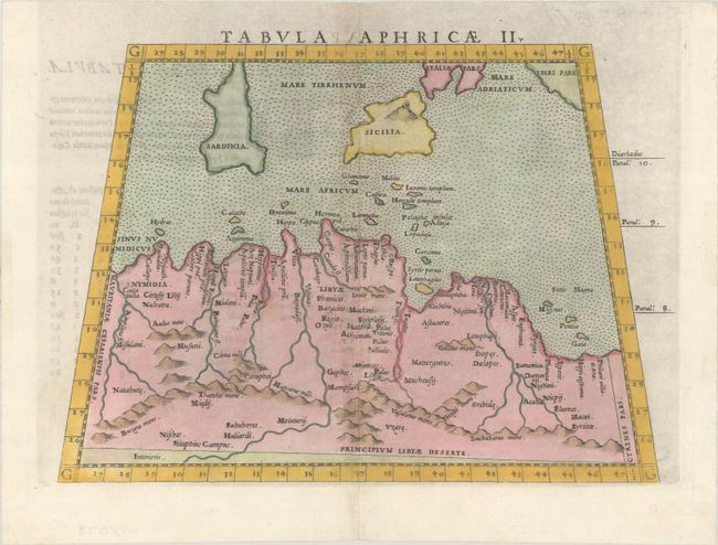
Subject: Northern Africa

Period: 1562 (circa)

Publication: Geographia Cl. Ptolemaei Alexandrini...

Color: Hand Color

Size:
9.9 x 7 inches
25.1 x 17.8 cm
Download High Resolution Image
(or just click on image to launch the Zoom viewer)

Claudius Ptolemy was a mathematician, astronomer and geographer who worked in Alexandria, then a part of the Roman Empire, in the 2nd century AD. One of the most learned and influential men of his time, his theories dominated both astronomy and geography for nearly 1500 years. His writings were kept alive by Arabic scholars during the Middle Ages and reemerged in Europe during the Renaissance. The birth of printing led to wide dissemination of his great works on astronomy and geography. There were a number of editions of his Geographia beginning in 1477. These early editions contained maps based on his original writings, known as Ptolemaic maps. As geographic knowledge increased with the explorations of Columbus, Magellan, Cabot and others, maps of the New World were added, and maps of the Old World were revised. Ptolemy's Geographia continued to be revised and published by some of the most important cartographers including Martin Waldseemuller, Sebastian Munster, Giacomo Gastaldi, Jodocus Hondius, and Gerard Mercator (whose last edition was published in 1730).

This Ptolemaic map of northern Africa covers portions of Algeria, Tunisia, and Libya and extends to include the islands of Sicily and Sardinia. Exaggerated rivers and mountain ranges are shown, and a flaming Mt. Etna appears in Sicily. Latin text on verso.

References: Mickwitz & Miekkavaara #217-33.

Condition: A

A nice impression on a bright sheet with professional repairs to a short tear along the centerfold.

Estimate: $120 - $150

Sold for: $90

Closed on 11/17/2021

Archived