Catalog Archive
Auction 185, Lot 513
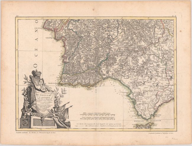
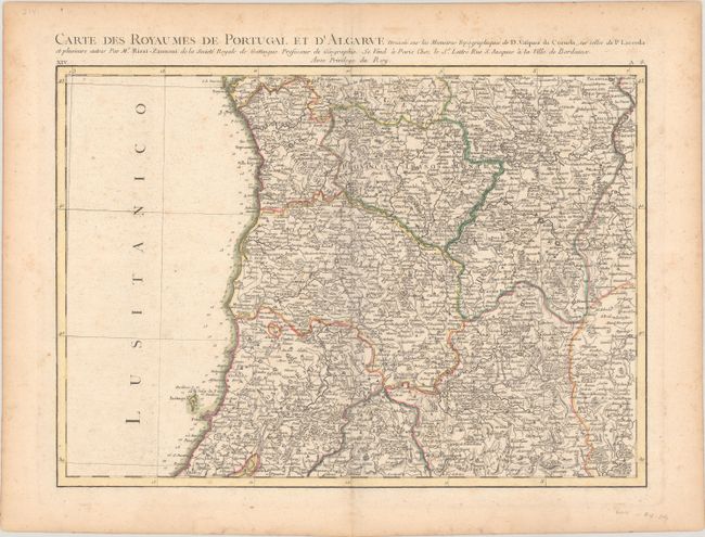
"Mapa dos Reynos de Portugal e Algarve Feita Sobre as Memorias Topografica de D. Vasque de Cozuela as do P. Lacerda e Varias Outras", Rizzi-Zannoni, Giovanni Antonio
1 of 2
Subject: Portugal & Western Spain
Period: 1775 (circa)
Publication: Atlas Moderne
Color: Hand Color
Size:
16.8 x 12 inches
42.7 x 30.5 cm
Download High Resolution Image
(or just click on image to launch the Zoom viewer)
(or just click on image to launch the Zoom viewer)