Catalog Archive
Auction 185, Lot 470
NO RESERVE
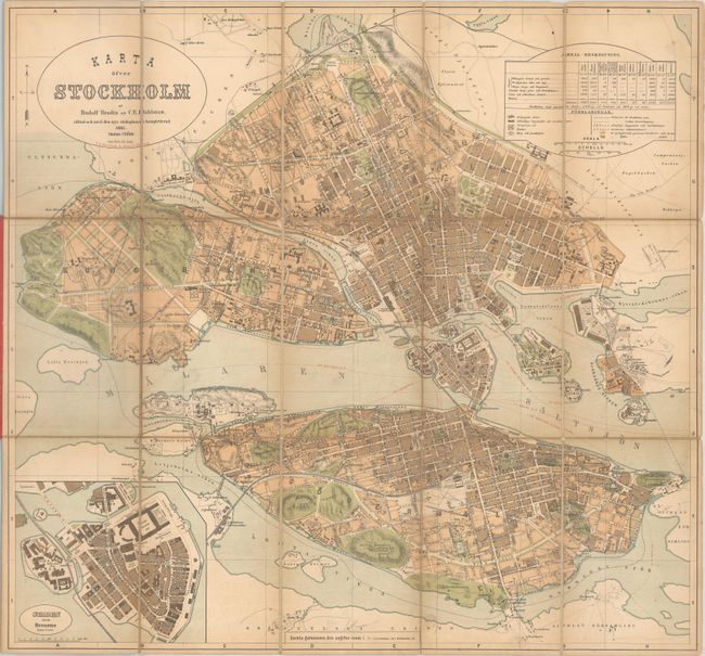
"Karta ofver Stockholm",
1 of 2
Subject: Stockholm, Sweden
Period: 1885 (dated)
Publication:
Color: Printed Color
Size:
22.1 x 20.7 inches
56.1 x 52.6 cm
Download High Resolution Image
(or just click on image to launch the Zoom viewer)
(or just click on image to launch the Zoom viewer)