Catalog Archive
Auction 185, Lot 357

De Fer's Important Map of the Island of California

"Cette Carte de Californie et du Nouveau Mexique…", Fer, Nicolas de

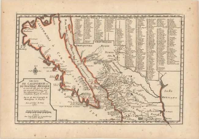
Subject: Southwestern United States & Mexico, California

Period: 1700 (dated)

Publication: Atlas Curieux

Color: Hand Color

Size:
13.3 x 8.8 inches
33.8 x 22.4 cm
Download High Resolution Image
(or just click on image to launch the Zoom viewer)

This small map is very important in the cartographic history of California and the Southwest. Ironically it is one of the only maps of the period to focus on the island of California, and the first map to show the discoveries of Father Eusebio Kino, the man who disproved that California island theory. According to Wagner, the map is purportedly based on a manuscript drawn by Father Kino in 1696. The island is named Californias o Carolinas and a number of new place names are introduced here for the first time, including the interestingly titled Ba. d. las 11000 Virgenes (Bay of 11,000 Virgins). Numerous place names are shown in what is now the southwestern part of the United States, including Santa Fe, Acoma, and Casa Grande. Additionally 314 different places are located and keyed to a table that fills a large portion of the map; thus presenting remarkable documentation of the native settlements in the region. Engraved by Inselin, who also engraved Kino's famous map. This is the important first state.

References: McLaughlin #134; Tooley (Amer) p.126, #62; Wagner (NW) #462; Wheat (TMW) #78.

Condition: B+

Contemporary outline color and sharp impression with light spots mostly confined to the blank margins and light toning along the edges of the sheet. The very bottom right tip of the map was torn off and professionally and seamlessly reattached.

Estimate: $950 - $1,200

Sold for: $1,200

Closed on 11/17/2021

Archived