Catalog Archive
Auction 185, Lot 270

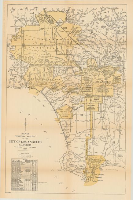
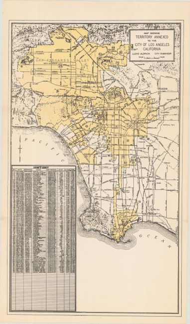
"[Lot of 2] Map of the Territory Annexed to the City of Los Angeles [and] Map Showing Territory Annexed to the City of Los Angeles",

Subject: Los Angeles, California

Period: 1920-45 (circa)

Publication:

Color: Printed Color

Size:
See Description
Download High Resolution Image
(or just click on image to launch the Zoom viewer)

Two maps showing the progress of annexations in Los Angeles between 1920 and 1945:

A. Map of the Territory Annexed to the City of Los Angeles, by John A. Griffin, dated 1920 (15.4 x 24.1"). A scarce map of the Los Angeles region that depicts the then-present boundaries of the city. It delineates the original square boundary of the city as of 1850 with the numerous additions/consolidations radiating both south and west. A table at bottom left shows the annexation history including the St. Francis Addition that occurred in February of 1920. Condition: Light toning along the fold lines. (B+)

B. Map Showing Territory Annexed to the City of Los Angeles, by Lloyd Aldrich, circa 1945 (10.1 x 17.1"). An updated and reduced version of the map above. An annexation "history" table includes 96 annexations with the location of each noted on the map. The last annexation listed was August 27, 1945. Condition: Clean and bright. (A)

References:

Condition:

Issued folding. See description above.

Estimate: $220 - $250

Sold for: $350

Closed on 11/17/2021

Archived