Catalog Archive
Auction 185, Lot 258

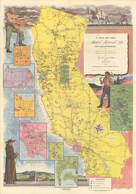
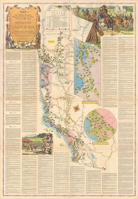
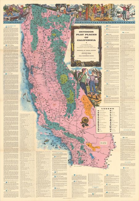
"[Lot of 3] A Map of the Marked Historical Sites of California... [and] A Map of the Missions, Presidios, Pueblos and Some of the More Interesting Ranchos of Spanish California... [and] Outdoor Play Places of California...", Automobile Club of Southern California

Subject: California

Period: 1952-56 (dated)

Publication:

Color: Printed Color

Size:
See Description
Download High Resolution Image
(or just click on image to launch the Zoom viewer)

Three large, colorful pictorial maps of California by Lowell Butler that were issued as supplements to the ACSC's Westways magazine:

A. A Map of the Marked Historical Sites of California Compiled from the Official Registrations of the California State Department of Natural Resources, dated 1952 (27.7 x 39.9"). An extensive table on verso listing hundreds of historical landmarks around the state are keyed to this map "with the hope that it will acquaint many motoring Californians, native, adopted and transient, with the glorious heritage of the commonwealth beside the Pacific Ocean." The map is surrounded by insets of San Diego, Los Angeles, San Francisco, Monterey and the Gold Region. Large illustrations of a farmer, miner, timber jack and friar compliment the map. Self-folding (7.3 x 10.4").

B. A Map of the Missions, Presidios, Pueblos and Some of the More Interesting Ranchos of Spanish California Together with the Routes of the Principal Land Explorations Therein, dated 1956 (31.0 x 44.9"). 280 points of interest are keyed to this map emphasizing Spanish California. Locates missions, presidios, pueblos, and ranchos along with a legend summarizing exploration routes in region from 1767 to 1823. Decorated by a strapwork title cartouche and related illustrations. Self-folding (8.0 x 11.5").

C. Outdoor Play Places of California - A Cartographic Map of Some of the Outstanding Recreational Areas of the Golden State, dated 1954 (30.5 x 44.3"). This map promotes the recreational activities in the state with over 300 points of interest keyed to the map. A legend further identifies national parks, national forests, ski areas, yacht clubs, and a variety of wildlife. Includes large illustrations of people enjoying the outdoors. A contemporary review of the map was included in Volume 7, Number 1 of the UCLA Librarian (October 9, 1953): "A copy of this excellent map has just been added to the map collection in the Department of Special Collections, and William Bellin, the curator, thinks everyone ought to have one. With a minimum of confusion, he says, the map shows the national forests and state parks, and how to get to them, and also the haunts of fish and game of various sizes, and how to get to them. Places for skiing, sailing, and just sitting are also pointed out; and added notes tell the visitor what he may do and when. The map sheet itself is large and decorative, with robust color and exuberant pictorial vignettes, and is similar in format to the Map of the Marked Historical Sites of California issued by the same publisher in 1952." Self-folding (8.0 x 11.5").

References: Rumsey #6834, 6835 & 6836.

Condition: A

Clean and colorful examples with a few small splits at the fold junctions. Issued folding.

Estimate: $180 - $220

Sold for: $120

Closed on 11/17/2021

Archived