Catalog Archive
Auction 185, Lot 24

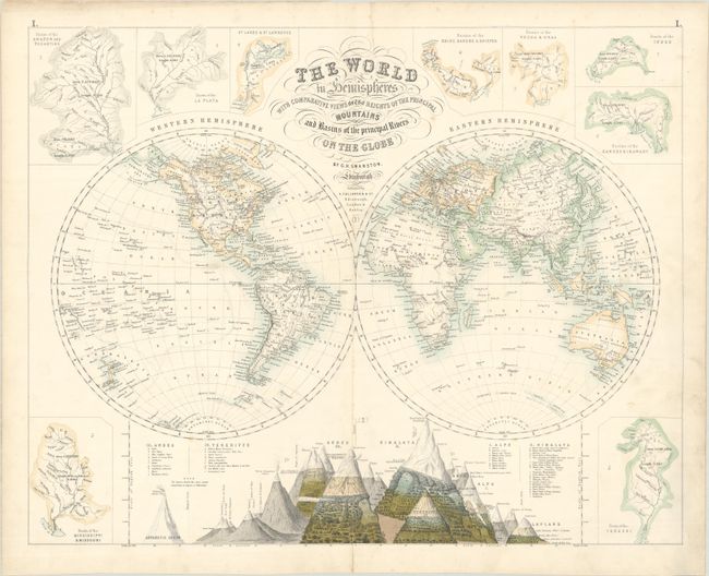
"The World in Hemispheres with Comparative Views of the Heights of the Principal Mountains and Basins of the Principal Rivers on the Globe", Swanston/Fullarton

Subject: World

Period: 1872 (circa)

Publication: The Royal Illustrated Atlas

Color: Hand Color

Size:
20.9 x 16.6 inches
53.1 x 42.2 cm
Download High Resolution Image
(or just click on image to launch the Zoom viewer)

This attractive double-hemisphere world map is surrounded by an elaborate comparative view of principal mountains. The map focuses on rivers and a few key cities and includes a broken outline of Antarctica. In addition to the comparative mountain view, the basins of the most important rivers around the world are shown, including the Amazon, La Plata, Rhine, Danube, Volga, Indus, Ganges, Yenesei, Mississippi, and Missouri rivers.

References: Rumsey #3007.001.

Condition: B+

There is a 2" tear at center and a 1" tear at top that have been professionally repaired on verso. Some minor centerfold separations have also been archivally repaired and there is light soiling.

Estimate: $160 - $190

Sold for: $200

Closed on 11/17/2021

Archived