"United States", Smith, Charles
Subject: Eastern United States
Period: 1820 (dated)
Publication: Smith's New General Atlas
Color: Hand Color
Size:
14.4 x 11 inches
36.6 x 27.9 cm
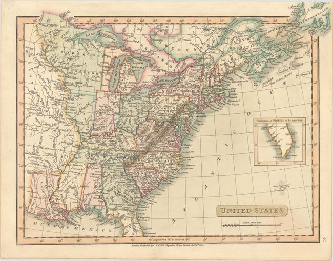
Attractive map of the United States focusing on the states east of the Mississippi River with Missouri Territory beyond. North West Territory takes in the region of present-day Wisconsin and Minnesota. Ohio, Indiana and Illinois are misplaced too far west and Lake Michigan is too small, so that Illinois does not have a border on Lake Michigan. There are several interesting notations concerning early boundaries and several early roads are shown. The southern part of Florida is shown in a inset. The map extends north to include Newfoundland beyond the map border.
References: Phillips (Atlases) #6042-50.
Condition: A
A crisp impression on a clean sheet.