Catalog Archive
Auction 184, Lot 96

"L'America Settentrionale e Meridionale Approvata Dalla Direzione Generale di Pubblica Istruzione per Uso delle Scuole del Regno d'Italia", Bordiga, F.

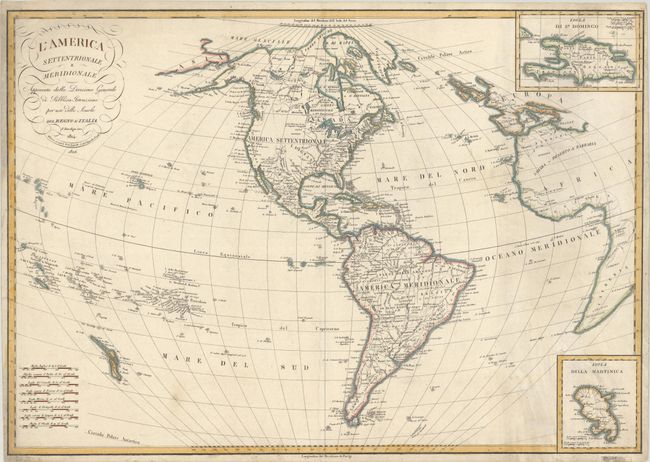
Subject: Western Hemisphere - America

Period: 1826 (dated)

Publication:

Color: Hand Color

Size:
29.1 x 20.4 inches
73.9 x 51.8 cm
Download High Resolution Image
(or just click on image to launch the Zoom viewer)

This scarce Italian map features fine engraved lines and an unusual projection. In North America, Alaska is fairly well formed and labeled Alaska in the western end of the Alaska Peninsula. The United States extends to the Mississippi, with Luigiana (Louisiana Territory) to its west. Texas is named along the R. aux Cannes, and New Mexico is a narrow column bounded by the Rio Grande that includes Santa Fe and Taos. South America is well shown with all political divisions delineated. The map extends to part of Africa and Europe, and all of Great Britain. In the Pacific Ocean, the map identifies the Sandwich Islands. There are two insets: Isola de St. Domingo (top right) and Isola Della Martinica (bottom right). The title contains flourishes and some script. Eight distance scales are stacked at lower left.

References:

Condition: B+

On a sturdy sheet with light soiling and a couple of old tape stains confined to the bottom blank margin.

Estimate: $230 - $275

Sold for: $170

Closed on 9/15/2021

Archived