"L'Amerique Divisee dans les Principaux Etats avec les Nouvelles Decouvertes du Capit. Cook Depuis le Detroit de Behrings Jousqu' au Nord dans l'Ocean Pacifique et du Capit. Jean Meares dans les Annees 1788 et 1789", Delamarche, Charles Francois
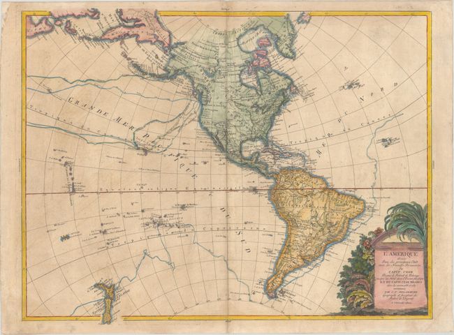
This large, rare map of the Americas extends to show New Zealand, a portion of northeastern Asia, and part of Japan. Within the United States, important cities and settlements such as Jamestown, Philadelphia, Boston, Charleston, and New Orleans are identified, as are the locations of several Indian tribes. Cook's discoveries in Hawaii and Alaska are reflected within the map, as are his routes throughout the oceans. John Meare's routes appear near Alaska, and the northwest coast is presented in Meare's configuration with a Sea of the West (Vue de la Terre la Mer la Mer). In addition to Hawaii, many other islands in the Pacific are also included. The Caribbean and South America are rendered in fine detail. A decorative title cartouche featuring indigenous vegetation adorns the bottom right corner.
References: McGuirk #235.
Condition: B
Issued on watermarked paper with some light toning and soiling. The top right corner of the sheet is lightly creased.